The digital elevation dataset resulting from the SRT Mission in the year 2000 is probably the most widely used digital elevation dataset in the world. It was first released with a 90 at ground resolution in a more or less global level (56° S to 60° N). In 2014 the White House announced the release of the 30 m original solution dataset. So they released parts of the dataset one-by-one. Our author Christoph just mentioned an update via Twitter.
And by looking on the calendar we checked back again: The gaps of the dataset are now filled and you can download this great resource for free:
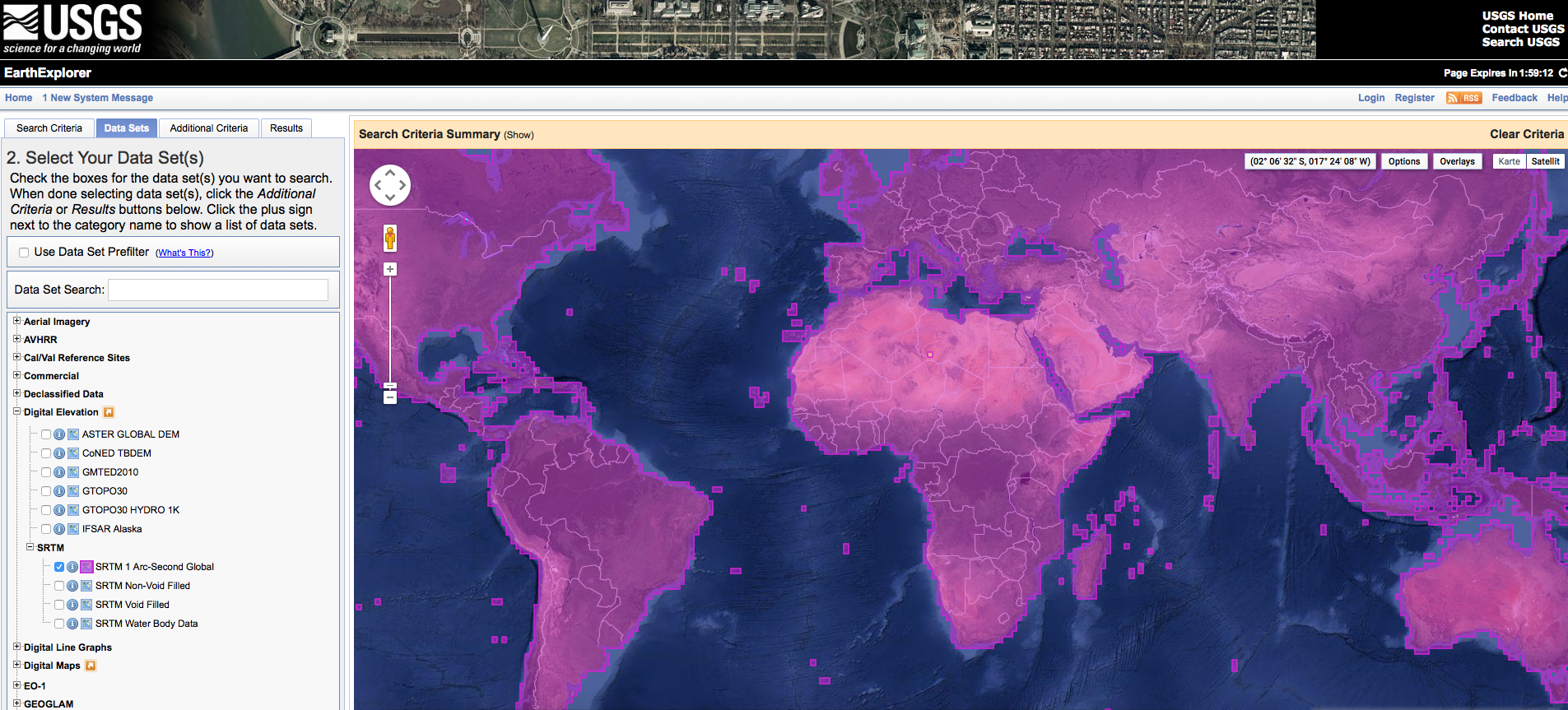
global coverage of the SRTM 1 dataset
To work with data you only need an account at the GLCF website. As an alternative I would like to point to another resource for elevation data. The website www.opentopography.org provides access to the SRTM 1 dataset via an Rest API.
The only thing needed?
demtype
The SRTM dataset – Global 90m is ‘SRTMGL3’ and Global 30m is ‘SRTMGL1’
west, south, east, north
WGS 84 bounding box coordinates
outputFormat
Output Format (optional) – GTiff for GeoTiff, AAIGrid for Arc ASCII Grid, HFA for Erdas Imagine (.IMG). Defaults to GTiff if parameter is not provided
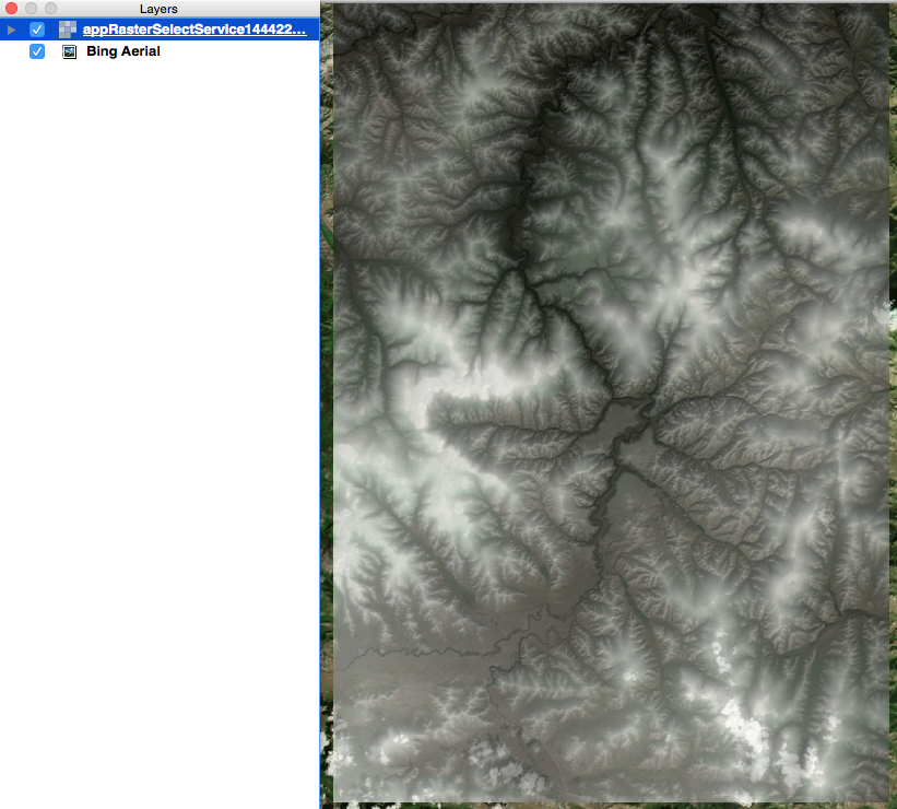
You might get a nice DEM for the desired area as download and to use in your favourite GIS:
SRTM 1 extract in QGIS
At the moment I would prefer to work with this SRTM 1 dataset as it is shipped by a manifold of services, reliable, more or less a current DEM. Compared to ASTER (artefacts as fuck!) and ALOS 30m (will be available worldwide someday) I would grab the NASA data without the blink of an eye. But hey, it depends on your research question or the requirements of your project whether this dataset will please you…
When it comes to height data: what do you prefer and in which project did you used it?
With this post I would like to come back on a topic from September 2014. In this blog post on Digital-Geography I announced that from September 2014 until…
I don’t know what’s wrong with the governmental insitutions in Germany/Berlin: They have this law, that all the geodata are somehow under an open license but to me…
Since one month, the 2nd version collection data of Advanced Spaceborne Thermal Emission and Reflection Radiometer (ASTER) are now available online. This data is now worldwide available for…
Christoph already wrote an article about “How to find geospatial data for Spain” and also mentioned the IGME page but thanks to Mr. Nölte from the Dechenhöhle in…
The add wms/wmts layer command in qgis does not work with the url http://ot-data1.sdsc.edu:9090/otr/getdem?demtype=SRTMGL1&west=100&south=48&east=101&north=49&outputFormat=GTiff
what I am doing wrong?