Since one month, the 2nd version collection data of Advanced Spaceborne Thermal Emission and Reflection Radiometer (ASTER) are now available online. This data is now worldwide available for free and is made possible by the NASA and the METI. Even if according to NASA the data is produced with the same gridding as the first version, some large improvements have been made, such as:
* a smaller amount of artefacts
* an increase in horizontal and vertical accuracy
* an improved horizontal resolution
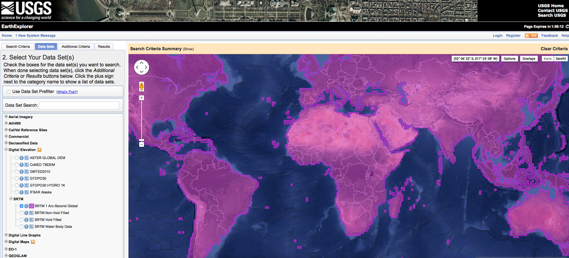
Search HERE for the new ASTER data for your area and download it!
Want to know more about the new ASTER products, have a look at this website.
[…] ist die Erstellung einer topographischen Karte unter Verwendung von ASTER GDEM Höhendaten (Anwendbar auch für […]
… [Trackback]…
[…] Read More Infos here: digital-geography.com/2011/12/version-2-aster-data-now-available/ […]…
Hello
I tried to download the data set ASTER
GDEM V2, format GeoTIFF for Ukraine/Khar’kov but when I click on
download the message “Failed to mosaic and clip” appears.
What I have to do to download it correctly?
Thanks a lot
Anja