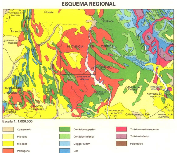
Christoph already wrote an article about “How to find geospatial data for Spain” and also mentioned the IGME page but thanks to Mr. Nölte from the Dechenhöhle in Germany we have now a detailed source to share: Geological maps scaled 1:50’000 are available for download as image files.
So you can use a very easy Interface to select the region of desire:
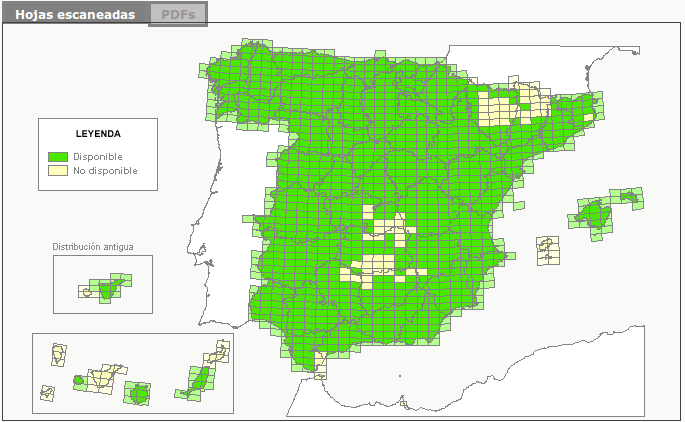
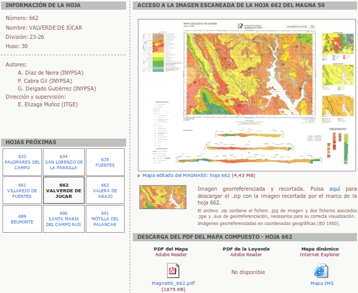
By pressing on one of the rectangles you’ll get the possibility to download the map as a pdf or a jpg file:
<
p align=”justify”>Both formats can be easily added to your ArcGIS or QGIS project. But nevertheless you will need to georeference the data as it lacks the spatial information. Unfortunately the pdfs have a minor pixel density compared to the jpgs. You can find tutorials on georeferencing those images for ArcGIS and QGIS on Youtube.
++++++++++++
Update
++++++++++++
Sorry for my mistake: Marta Gil commented, that there is a zip version of the jpg available. This contains a worldfile with coordinates. This works like a charm on QGIS. So you don’t need to georeference the image unless you want to do this by hand. Marta is working at the Universitat Autonoma de Barcelona in the map library. Thank you again for the advice!

Dear Riccardo, I don’t know if you have seen it, but this page offers the possibility of downloading georeferenced data. You have the “jpg whole map” as paper and also a cropped georeferenced image below. I think this option is not avalaible for every sheet, but maybe it could be useful for you.
Sincerely,
Marta Gil
Map library of Universitat Autònoma de Barcelona (UAB)