ESRI World Imagery Basemap
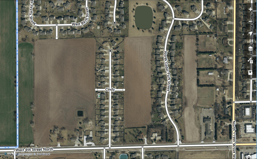
On 24th of August, Esri announced that it will make their World Imagery basemap available as editing basemap for the OpenStreetMap project. This will add even more sub-meter precission scenes to you, the OSM users. The World Imagery basemap contains not only 15m Landsat images (aka TerraColor) but also SPOT images with 2.5m and DigitalGlobe images with 30cm ground resolution. In few areas you even find aerial images with 3cm ground resolution according to the doc. I don’t know the exact diff between the Bing and Esri basemap. Both seem very similar. But yet there are differences. This makes it even easier to spot the differences in time and location and to map them. Unfortunately I only saw older images in Esri’s World Imagery: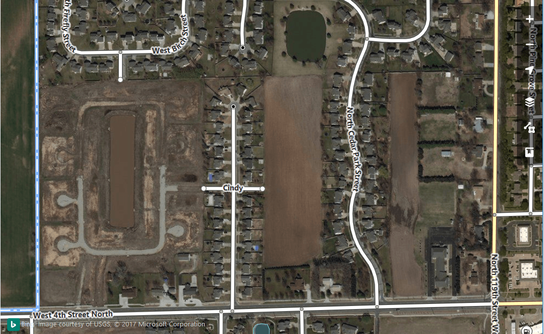
Conclusion
It is good to have alternatives like the ESRI World Imagery basemap if you’re manually digitizing or editing features in OpenStreetMap. Therefore the use of even more base material will increase the quality of OSM as a database and the webmapping product. Furthermore, iniciatives like the Humanitarian OSM Team (HOT) will definitely benefit of this addition.So grab your mouse and contribute to the OSM project. Use this one more basemap by editing with the iD editor or some of your choice.

Not as up to date as google earth
Please work on that
The Google maps API is quite clear with their license: It is prohibited to trace items using their maps/satellite images:
Are you dumb? Better be grateful for any fresh imagery.
Hi “Mail user”,
please stay calm and don’t use such rude words.
The Google maps API is quite clear with their license: It is prohibited to trace items using their maps/satellite images.
Better recommend JOSM as editor and not iD, which is for absolute beginners!