Routing is one of the main tasks when using Google Maps and co. Some systems are directly inserted into cars, some others should show us practical routes to the next supermarket or train station. Often routing services are associated with big commercial and proprietary providers like Google, TomTom, Nokia and other ones. In the mean time also routing services powered by the OSM (Open Street Map) community could provide proper routing to get you to your desired destination.
yournavigation.org
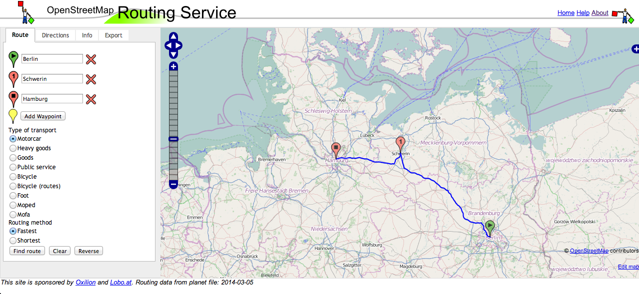
Yournavigation.org provides all essential functions of a routing service as start-, destination- and stopover-points and asks you whether you go by motorcar, transport heavy goods, goods, go by public service, bicycle, bicycle (routes), foot, moped or mofa. According to the speed limit and road type yournavigation.org processes the best route for your ride. Subsequent to the routing path you get the estimated travel duration and path-description. Very nice is the opportunity to save your routing course as .gpx, or .wpt-file so you can import it on your car navigations system or a handheld GPS.
Here you go: http://yournavigation.org/
openrouteservice.org
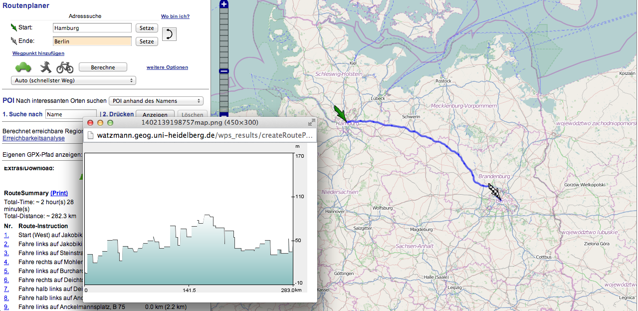
OpenRouteService.org provides OSM-based car-, bicycle and pedestrian-routing (also a wheelchair option is available). The special thing about this service is the opportunity to set a buffer to your routing path and show chosen OSM informations within. For example you can show all gas stations and supermarkets in your buffer zone and export it to your navigation system or GPS handheld.
After successful routing to your destination you can save your results as .gps, .xml or as weblink and you get a path description and the estimated duration. Special feature: you can show a height profile of your route.
Here you go: http://openrouteservice.org/
project-osrm.org
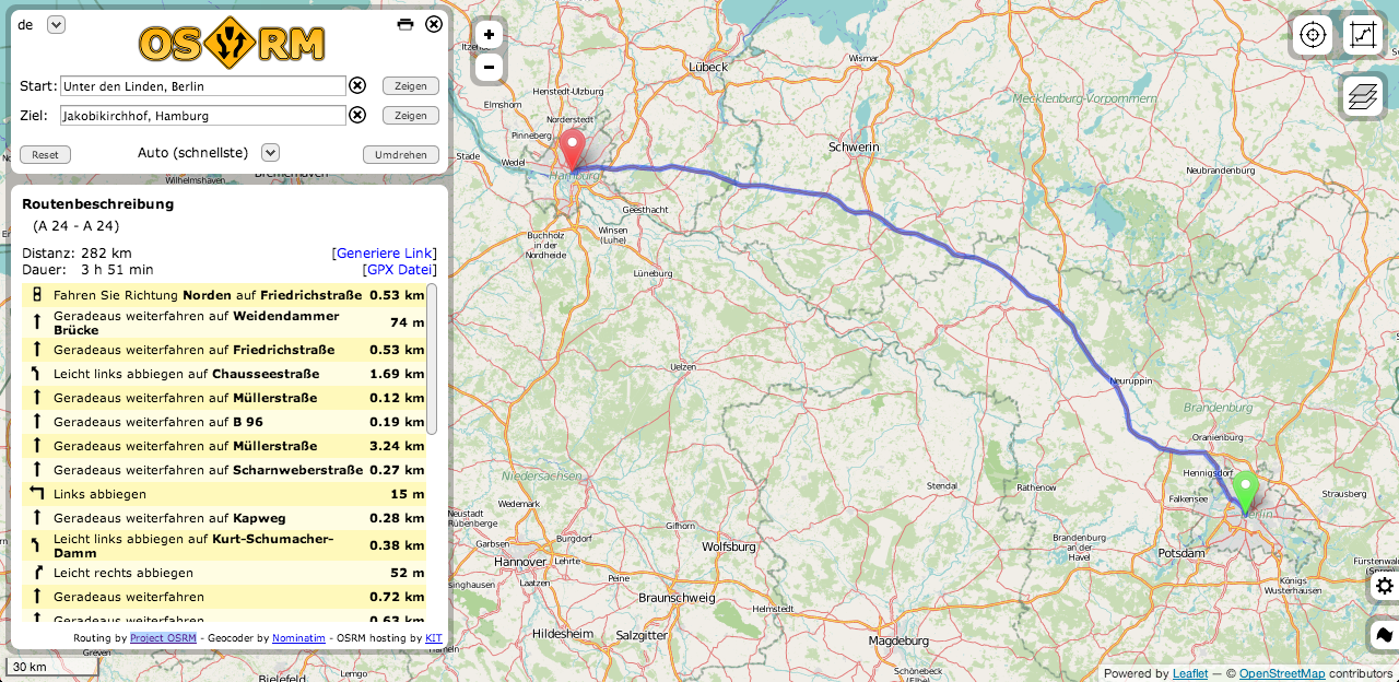
Project OSRM comparatively has the most clearest UI. Although there are less options and settings, you will get a high performance routing service and a nice drag & drop route adaption á la Google Maps. The usage of leaflet.js as webmap framework leads to a great look & feel.
Here you go: http://map.project-osrm.org/
Graphhopper
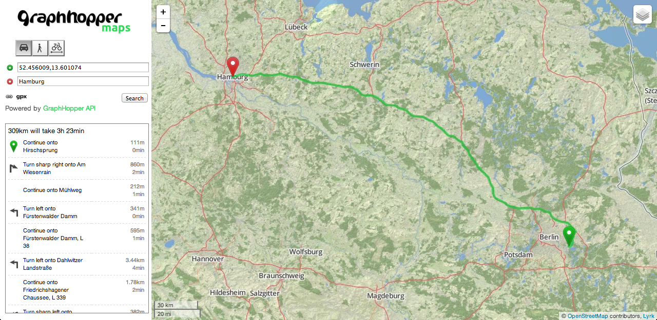
Graphhopper has also a clean UI and provides all basic features of a good routing service. Path description and .gpx-export are available. When you go by bicycle or foot you get a height profile. The offered API enables the usage of the routing power in other projects.
Here you go: http://graphhopper.com/