Mapbox created a cloudless Landsat map in 2013. That was a huge step for all the webmapping enthusiasts as we got a composit image of the world with stunning ground resolution and still cloudless! Now EOX, a company based in Vienna, provided a similar product called Sentinel Cloudless. And it is “for free”.
The Sentinel Cloudless Map
At the very moment the map is shipped as WMTS and WMS service in both: 4326 and 3857. As Klas already described on his post, the 4326 dataset performs a bit better.
The URLs are:
https://tiles.maps.eox.at/wmts/1.0.0/WMTSCapabilities.xml for WMTS
https://tiles.maps.eox.at/wms?service=wms&request=getcapabilities for WMS
Keep in mind:
Whenever you use Sentinel-2 cloudless an attribution has to be provided. It shall read “Sentinel-2 cloudless – https://s2maps.eu by EOX IT Services GmbH (Contains modified Copernicus Sentinel data 2016 & 2017)” including the links as given here where possible.
Problems of Sentinel Cloudless
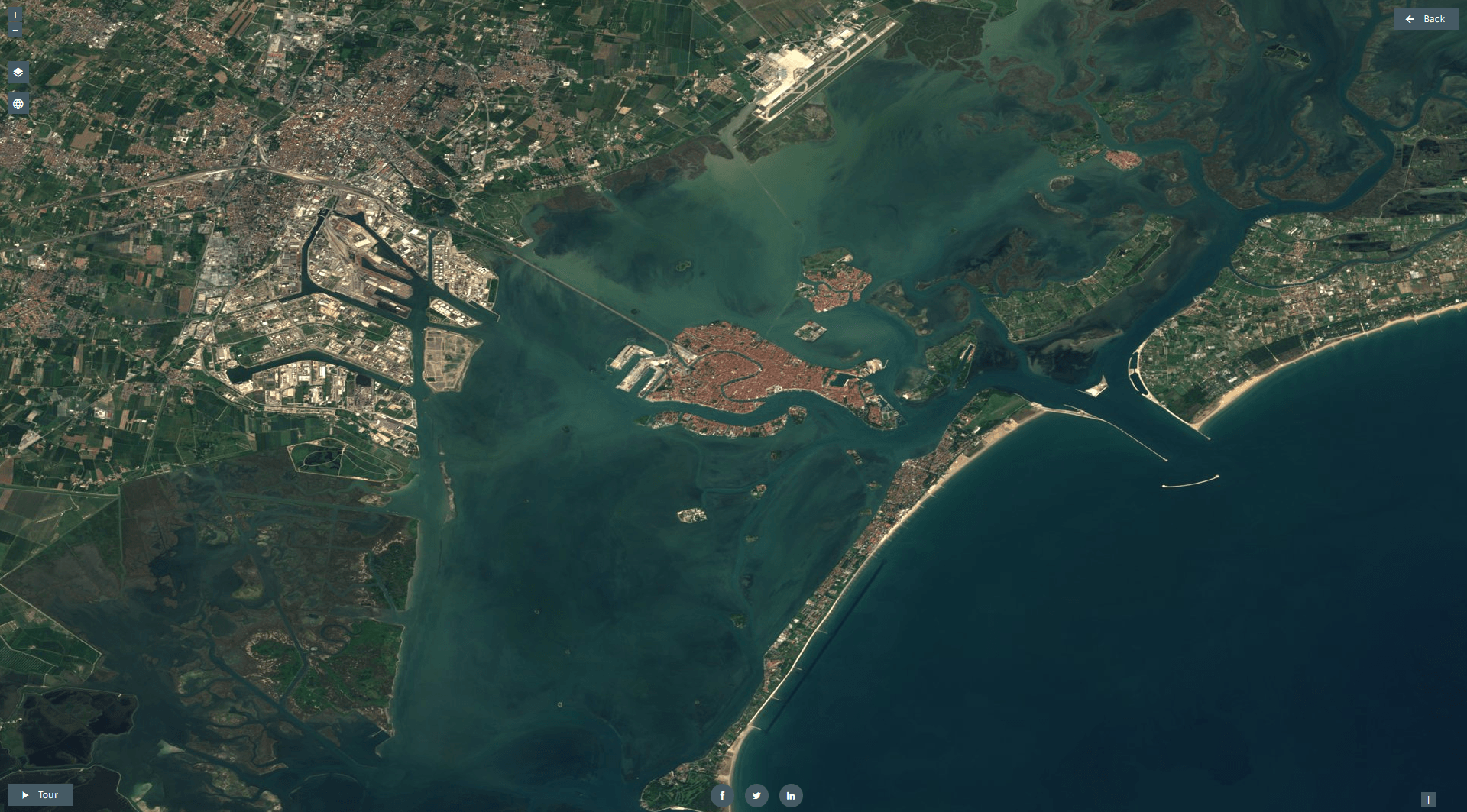
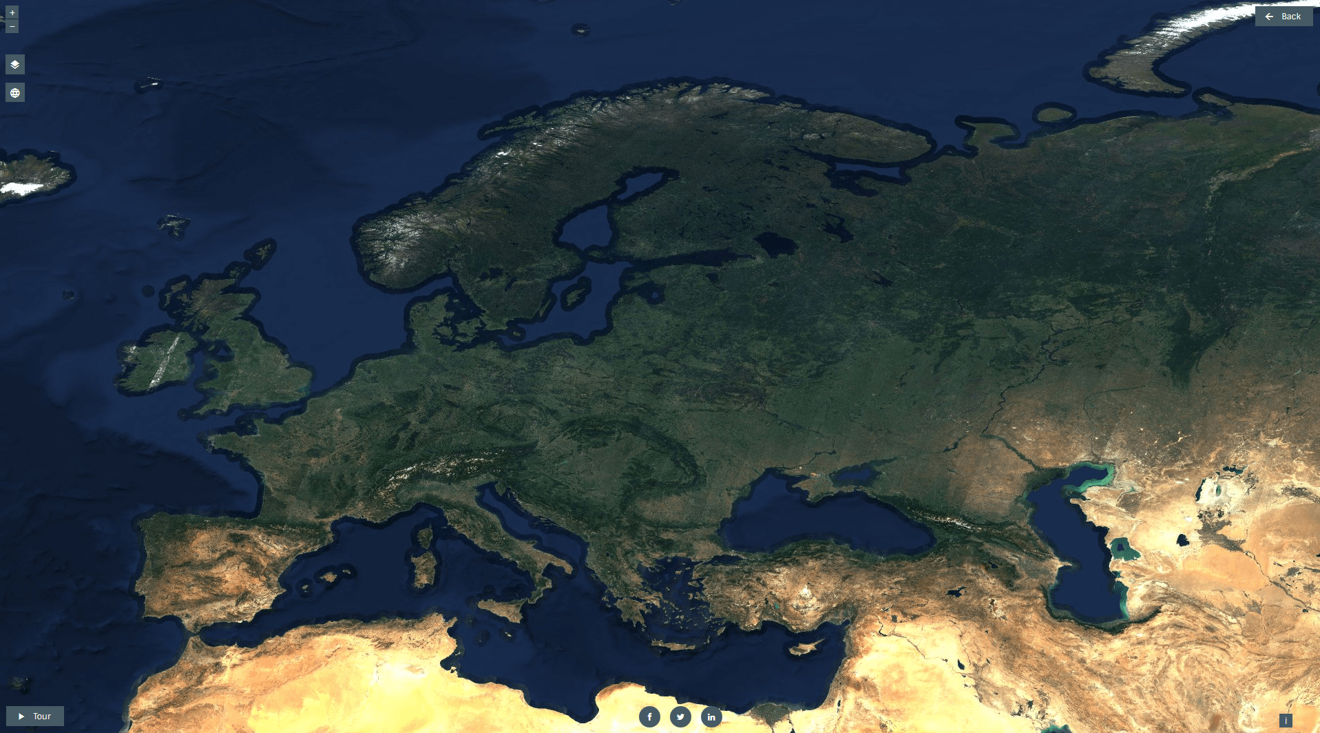
As a first look show the data is quite fine for the regions of Europe, North Africa and Western Asia:
Venice from above captured by Sentinel-2
Europe and North Africa captured by Sentinel-2
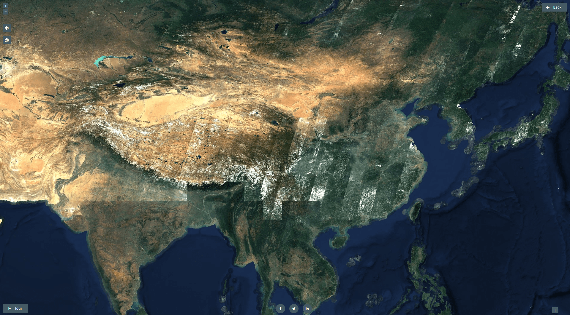
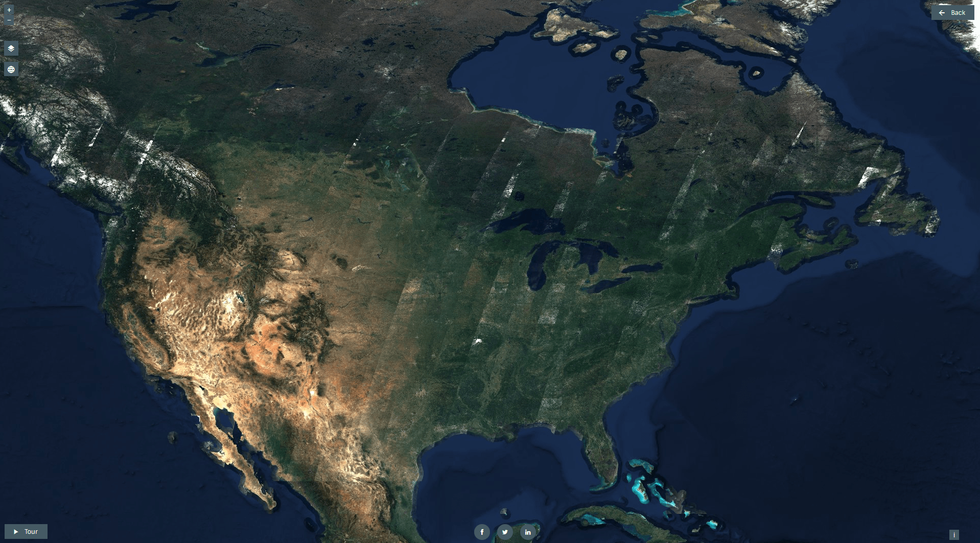
Yet you’ll also find some heavy stripping in different parts of the world:
Asia with heavy cloud coverage and break lines in India
Stripping in North America
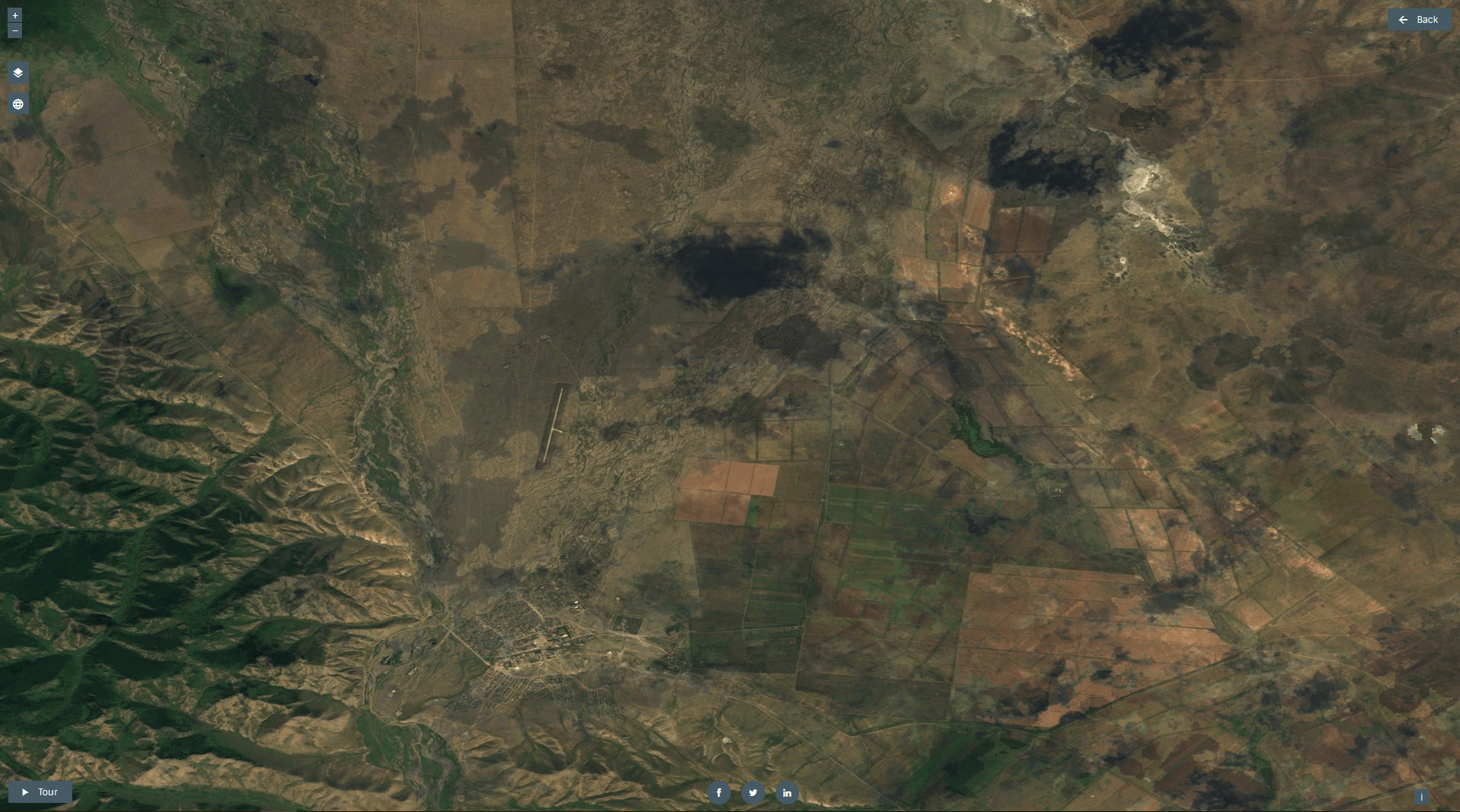
I observed another problem in my favourite working area in central Mongolia. Clouds were removed perfectly but you still see the shadows of clouds which is a bit confusing:
Cloud shadows in central Mongolia
Conclusion
I like the service as it provides a great basemap with ground solution at about 15m and I am looking forward the proposed integration of new images.
In the first two parts in our series on “getting to know openlayers” we concentrated on the question on layer consumption in form of basemaps and labels. We…
The Copernicus Program provides an interesting alternative data source for your work with Landsat data… Sentinel images: Copernicus will deliver an unprecedented volume of free data, provide new…
Sentinel-2 is the optical satellite of the Copernicus programme. It can be compared to Landsat, although it has a better resolution, of 10 to 20 meters. We’ll be…

GREAT! Thanks for sharing.
weather the cloudless of Sentinel’s data set had been available for South East of Asia region?