There are better examples and guidelines on how to visualize 3D data with ArcGIS in this video:
ArcGIS Earth
Google announced the ending of their Google Maps Engine (GME) in the beginning of 2015:In an effort to provide world-class location content to consumers and businesses alike and to build on the strength of our infrastructure and capabilities, Google will end support for the Google Maps Engine (GME) product on January 29, 2016. After January 29, 2016, the product will be deactivated and no longer available for use. As an organization, we want to focus our efforts on delivering rich location content via our APIs, and enabling customers to take advantage of the capabilities provided by our Google Cloud Platform products.After this, the market went into a “Game of Thrones” the GIS-style. And unsurprisingly one of the strongest pretender to the throne made an announcement with the not-yet-dead king Google:
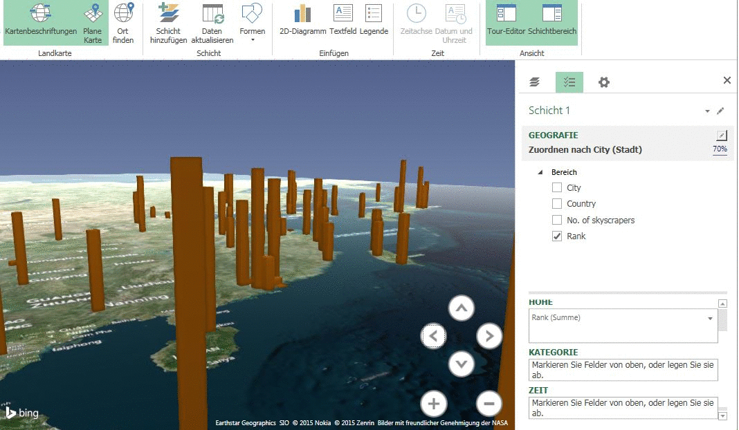
Google and Esri are working closely together to provide replacement software and training to all of Google’s enterprise customers and partners that have implemented Google Earth Enterprise and Google Maps Engine technology. Esri will be providing the new 10.3 version of ArcGIS for Server and related client/app technology to all Google Earth Enterprise and Google Maps Engine customers and partners.ESRI will publish a freely available software called “ArcGIS Earth” in December 2015 which will be an interesting alternative to the not-so-free ArcGIS online:
ArcGIS Earth is a freely available, lightweight, installable desktop app that makes viewing 3D maps instant and easy for anyone in the enterprise.If you’re interested then you might checkout this nice little presentation at ESRI UC 2015:
ArcGIS Earth and the 10.4. ArcGIS release will be the “first [release, where] ESRI has 3D across the ArcGIS stack” Chris Andrews ESRI product manager at GIScafe But ESRI is not the only king in the ring. Safe Software (the company behind FME, a tool to extract, transform and load data (ETL)) published a nice article in the beginning of this year where they show some alternatives.
If you need some help with your data and your “old” geodata infrastructure, you can also contact us.