CSV to HTML 101 webmap
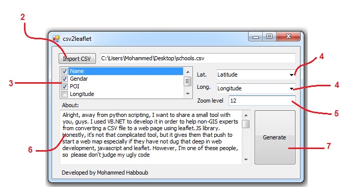
Alright, away from python scripting, I want to share a small tool CSV to HTML 101 with you, guys. I used VB.NET to develop it in order to help…
Since December 2014, I've been a geospatial engineer at United Nations Development Programme (UNDP - Gaza office) providing spatial solutions solving complex spatial problems, designing, building, publishing and updating spatial databases, analyzing big data, visualizing spatial data as well as generating story maps for infrastructure unit.
In 2014, I got my second Msc in Engineering Surveying with Geographical Information Science from The University of Nottingham - UK.
Alright, away from python scripting, I want to share a small tool CSV to HTML 101 with you, guys. I used VB.NET to develop it in order to help…
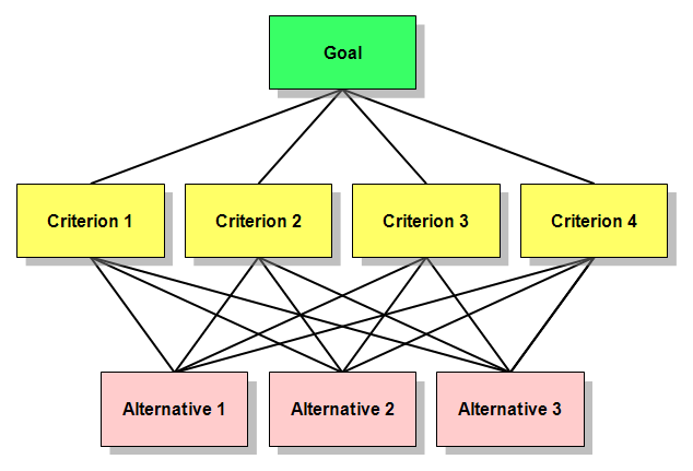
When it comes to site selection problems or suitability models, the spatial Multi-Criteria Analysis (Weighted Overlay) is the most commonly used method. It’s easy, simple and popular. However,…
After my first attempt in Python scripting using opensource Geospatial Data Abstraction Library (GDAL), I wanted to use ArcPy in my second trial. The following code is so…