The co-founder of webkid.io and interactive developer Moritz Klack recently shared a tweet about the Pixel Map Generator which is a nice addition to my recent “comparison” of different web mapping tools like AGOL, cartoDB and others. So let’s check it out.
Pixel Map by amCharts
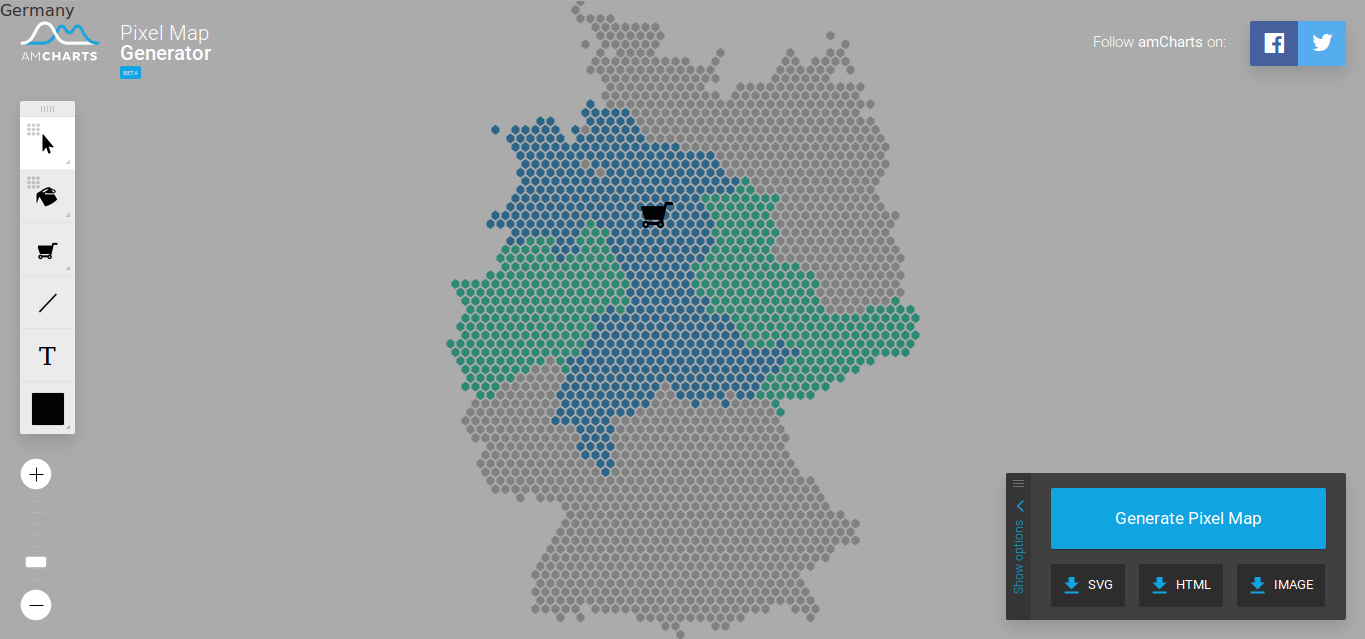
The Pixel Map Generator is created by amCharts and is a JS driven webpage with the aim to produce maps rather than to interact with your local/cloud data. It is built upon the product amMap from amCharts (you can download a free version of it and use amMap as well). But it does this beautifully:
Pixel Map Generator example
You can fill separate pixel as well as whole countries with colors of your choice, alter pixel sizes and forms a well as distances between pixel. Furthermore you can add markers lines or text labels…. Easy.
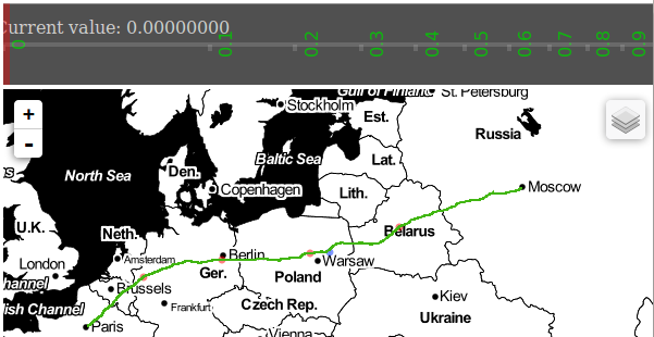
One more Thing: You want to have Bézier curves instead of straight lines. It’s easy as 123!
Unfortunately you can’t upload geojson files to be added to the webmap but the Pixel Map Generator is still in beta. So let us look forward to the next releases.
If you’re more interested in “localization”: You can choose the country of interest as well 😉
Pixel Map Generator example Germany
Pixel Map Generator: Exports
The best thing looking at the Pixel Map Generator are the export options:
SVG
HTML
Image
So it is more than easy to implement the produced map in your web content or the document of your choice
:
Full example as PNG download
When Mike Bostock published his (re-) implementation and demonstration of Visvalingams algorithm for line simplification he attracted considerable attention on that. What is a little bit strange in…
Due to our recent merge of geo-works.de and geo-affine.org we asked ourselves: Wouldn’t it be great to have a view of the origin of visitors of the blog?…
They could really use some other projections, though. It’s a shame they default that world projection.
Greenland lobbying^^
Pożyczki