The normal way of getting Landsat data for your GIS projects often was: visit a Landsat data mart like landcover.org, earthexplorer or WIST, search for your area and time and download/order your desired data. Once you’ve done this, you were prepared to add, analyse and publish this data/results with QGIS. Luca Congedo from the blog “From GIS to Remote Sensing” .
The Semi-Automatic Classification Plugin (SCP) is a free open source plugin for QGIS that allows for the semi-automatic classification (also supervised classification) of remote sensing images.
Also, it provides several tools for the pre processing of images, the post processing of classifications, and the raster calculation.
Once a domain of ERDAS, Matlab, R and other more numeric orientated software packages, SCP makes it possible to extract vector data from raster images in a convenient way:
You can download it via the plugin handler in QGIS.
Landsat and QGIS
In the newest version it uses the latest developments of Amazon which now offers Landsat data via direct access. Once installed, you can search, display and download Landsat 8 images via the SCP plugin directly in QGIS…
The main plugin window: SCP
The plugin has two main windows:
SCP: Classification – Here you can do your fancy classification steps and also download of data.
SCP: ROI creation – Here you define your Region of Interest.
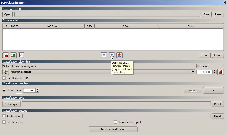
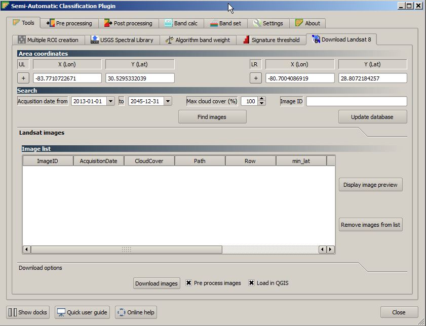
Once you choose to “Import […] USGS spectral library” a new window comes up with several tabs. One of them is called “Download Landsat 8”:
Landsat 8 downloader with filled corner coordinates
You just need to define the upper left and lower right corner coordinates by typing or interactive selecting via the cursor tool, select the required maximum cloud coverage as well as the temporal coverage and press the “find images” button to get a list of appropriate scenes.
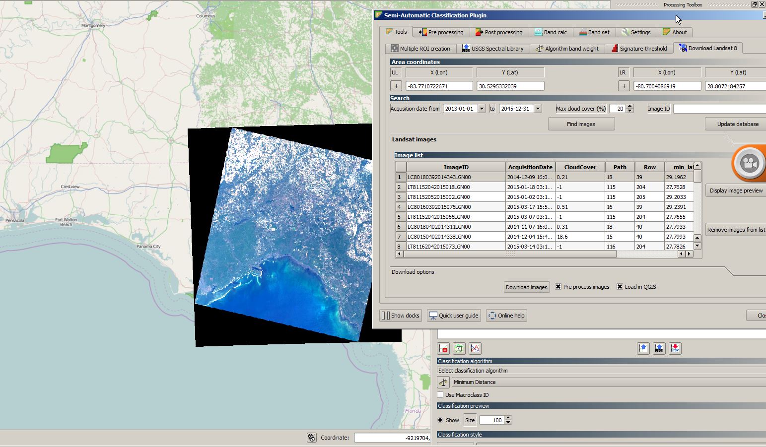
There is also the possibility to add the previews to your current project which is a nice way to get an idea about scenes: a 80% cloud coverage is not so bad if your ROI falls in the remaining 20% …
Landsat preview in QGIS
Once you’ve found a good scene, you can download it directly into your working folder:
folder with downloaded images
Summary
The newest version of the SCP plugin provides a great interactive way to browse and download Landsat 8 date for your specific area of interest. It has the advantage of offering all scenes instead of only selected snapshots as in other online services without any authentication or affiliation.
Unfortunately the progress bar for downloading images was not working in my example and I got always 0% till finishing the job. Especially for Landsat 8 it could be a good thing to have, keeping in mind that one scene has 740mb of data…
Further Information
Luca created a short “Tutorial” on this feature as a video. Enjoy it:
Routing with Google is quite cool as the database/network is probably the best currently available. But the terms of services limit the possible usage. So what about OpenStreetMap?…
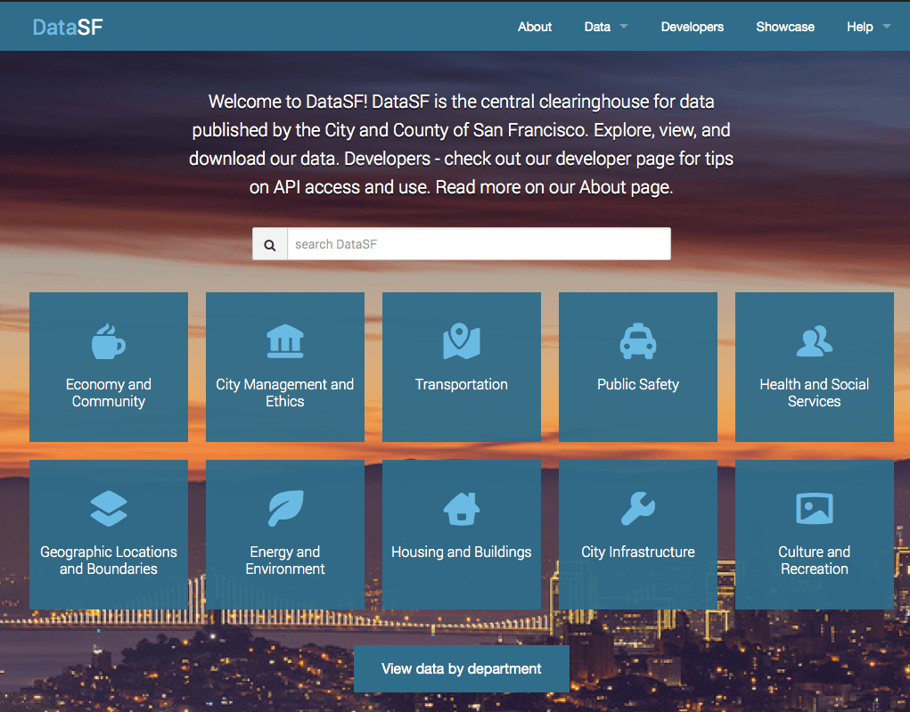
In 2010 the City and County of San Francisco’s official open data portal was launched. To me it is the ultimate experience for publishing/consuming open data: based on…


So nice !!
Awesome!