In 2010 the City and County of San Francisco’s official open data portal was launched. To me it is the ultimate experience for publishing/consuming open data: based on a WordPress system the city distributes data for several categories:
- Economy and Community
- City Management and Ethics
- Transportation
- Public Safety
- Health and Social Services
- Geographic Locations and Boundaries
- Energy and Environment
- Housing and Buildings
- City Infrastructure
- Culture and Recreation
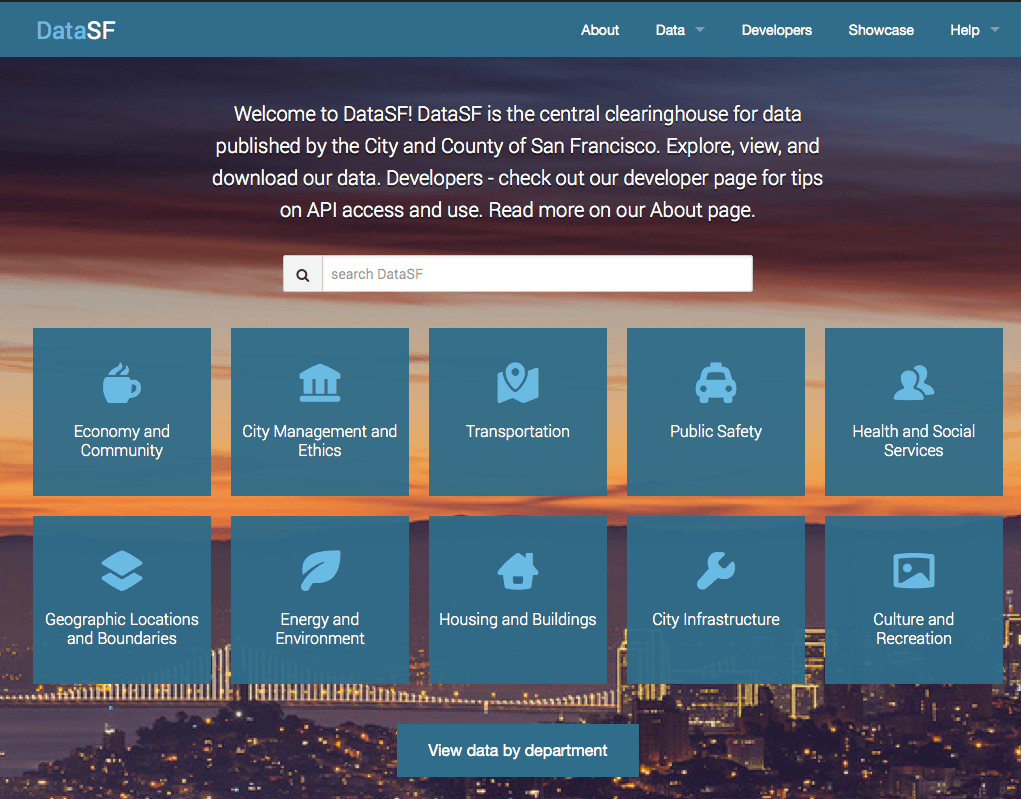
There are 820 datasets available at the moment. Depending on the source of the dataset you will either be able to download the data directly or to display it as table:
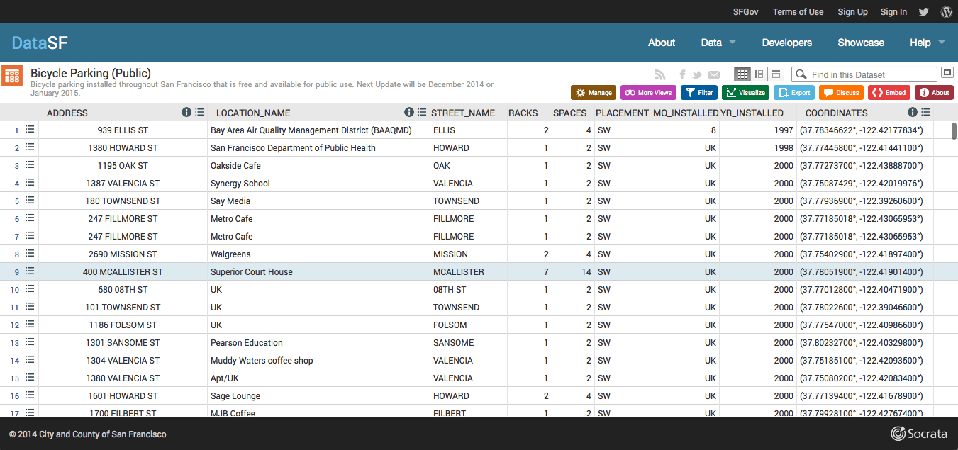
You can download the data in different formats or display them in several ways: piecharts, lines, box-diagramm or whatever might fit your needs. You can get the data without the need to register in ma tested cases.
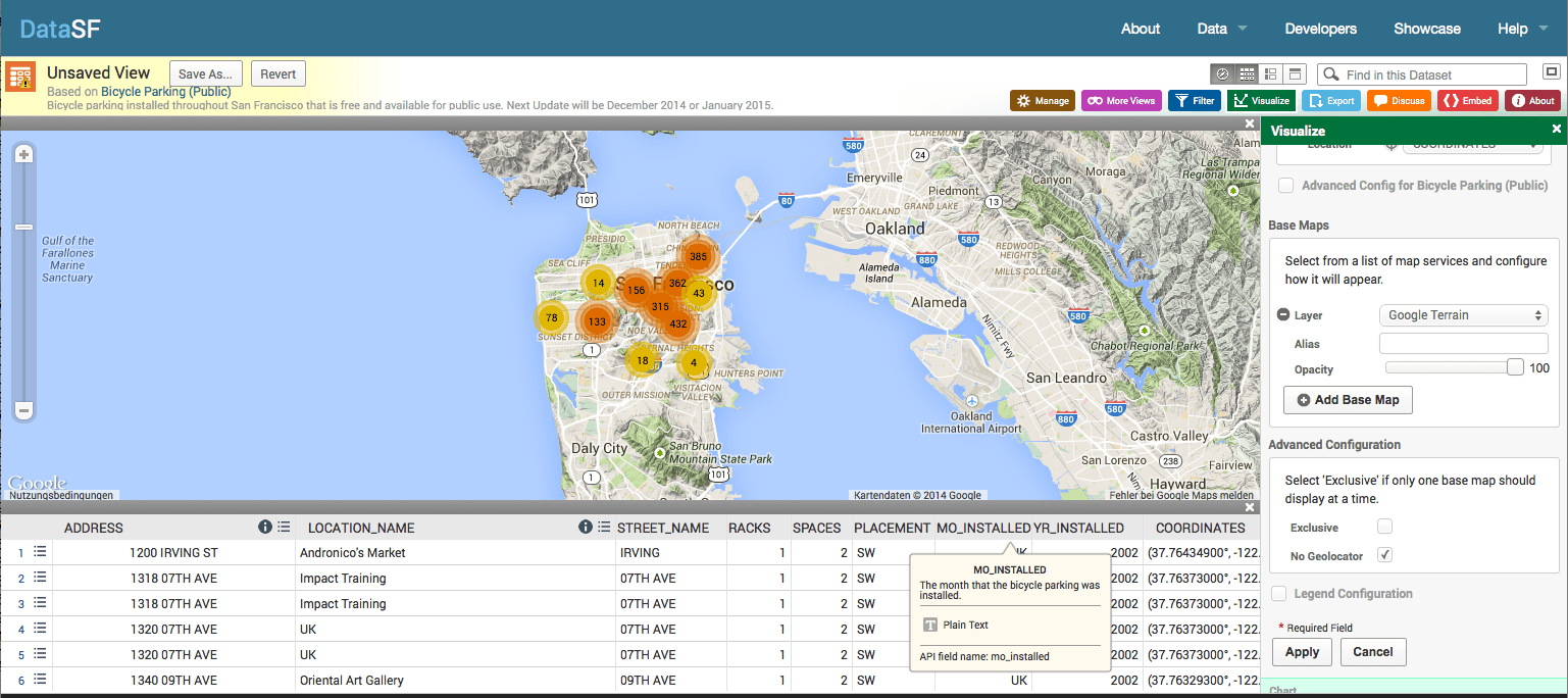
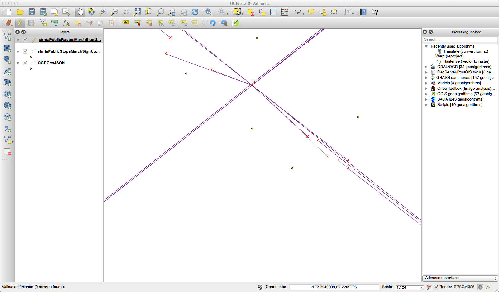
DataSF: Maptastic
Furthermore some of the data has a spatial dimension. For these datasets you can create a webmap with some simple clicks:
Of course the datasets are mostly (maybe always?) downloadable as well. Just download it and display it in QGIS: FTW!!!
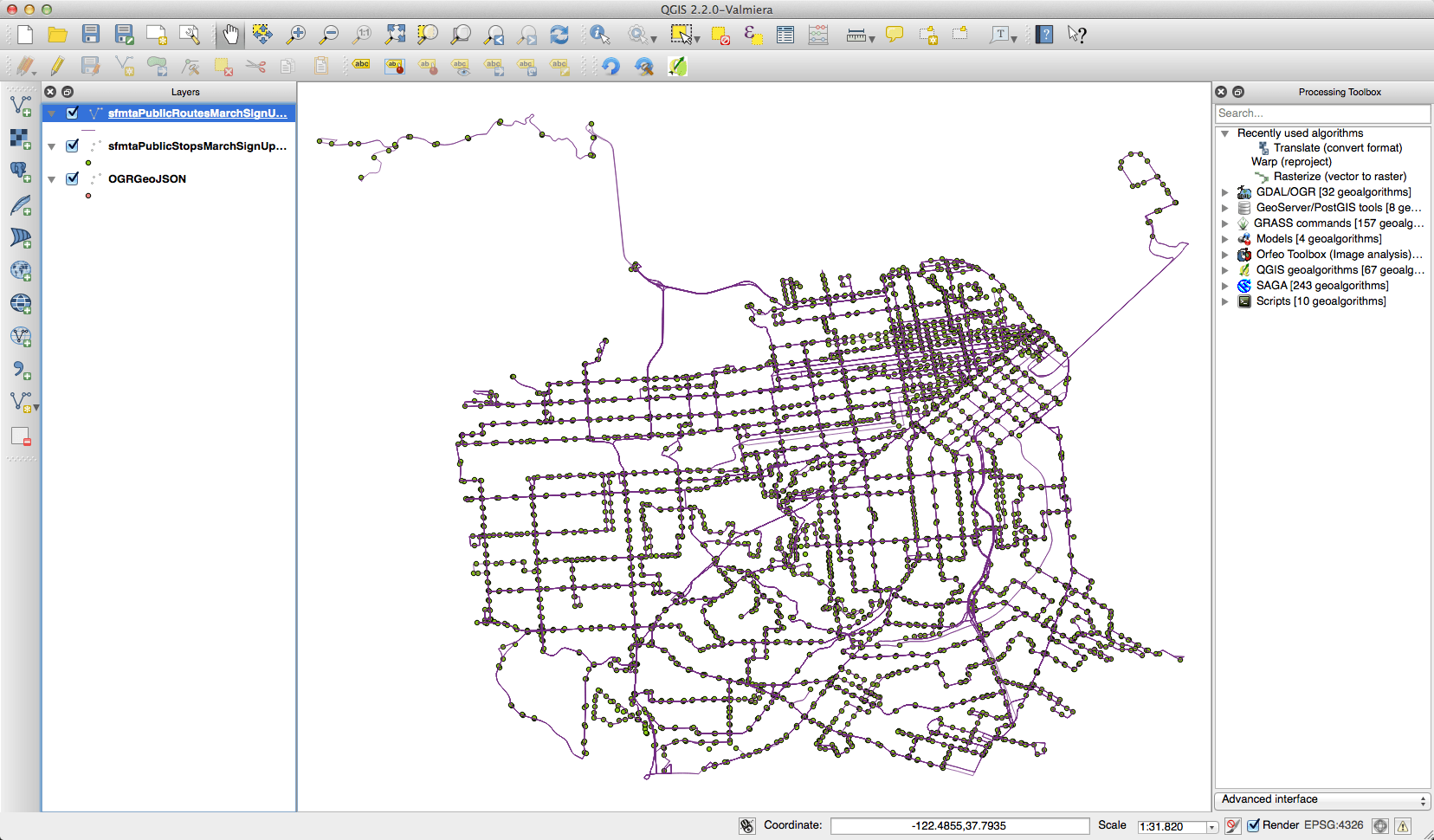
Of course this data needs a check as well! Nevertheless it is an easy interface, visulaisations are fast and beautiful, data export is without hurdles.
So if you’re planning to create or improve a data portal the site of DataSF is definitely worth a look!
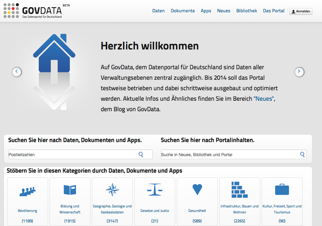
If you compare it with the services from GovData (the German open data portal) we have a winner for sure: San Francisco (350.000 inhabitants 😉 ). GovData doesn’t even have a complete coverage of zip-codes and a major keyword (1500 hits) is “inspireidentifiziert” which means that data is somehow relevant to INSPIRE. I doubt the public care about whether a dataset is identified for INSPIRE or not… But one thing is great at GovData: You can use GitHub to create issues on the plattform.

Without any doubt, the website has a smooth look and feel. Great example!
That is very nice. Another good example is Mecklenburg County, NC (Charlotte). http://maps.co.mecklenburg.nc.us/openmapping/index.html