Folks, have you ever questioned yourself how to show a shapefile or your own geotiff on a webmap as a WMS or WFS? MapServer is one thing to do this. Another on is Geoserver which seems to be used more often. MapServer, according to the WIKI entry will have it’s 20th birthday this year. So it’s time for us to support them to get ready for 20 more years.
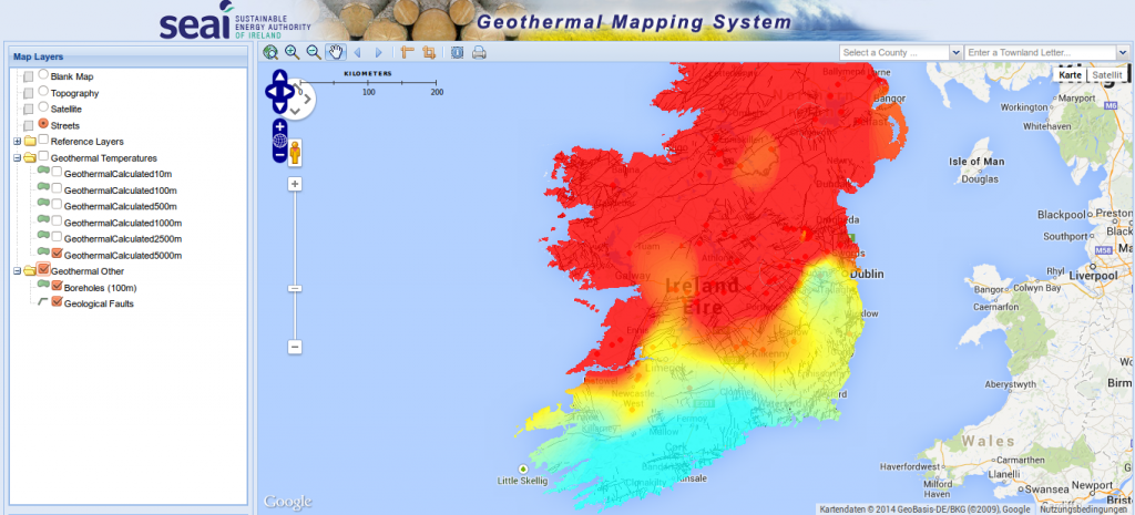
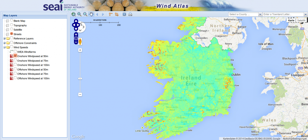
You can do great things with MapServer and leaflet/openlayers as you can see in this examples here:
Now MapServer tries to get ready for new users and wants to update its documentation. They use Transifex for this needed update (the last one is nearly 3 years old).
How can you help?
MapServer needs your translation! They have copied all there documentation to Transifex which provides an easy interface to manage translations. So get yourself an account – which is for free – and help those guys in their great work for the free and open source software movement.
I have already started a German translation but would like to encourage you to help me with this one or other languages.
Would love to help out with the German translation – will register tomorrow.
Great site btw @ digital-geography!
Thank you for your kind words!