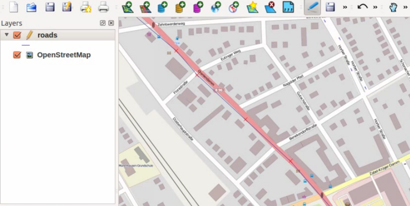
QGIS Tutorial III: from data to map – visualize data in a map
In our last session we started with some topographic “pre”-map as we prepared everything to create a printable map with QGIS which shows heights in a special area.…
In our last session we started with some topographic “pre”-map as we prepared everything to create a printable map with QGIS which shows heights in a special area.…
The new JSON Format GeoJSON allows you to easily embed geographical features in your leaflet webmap. Additionally you can create it very easily in the open source GIS…
Some days ago NASA has released “Black Marble”, an image of the world by night, a combination of photos taken by a new satellite. Its name was chosen…
In this tutorial I’ll show you, how to georeference a map using the open source software QGis. You can easily download and install QGis from the following Source: QGIS…
ArcGIS is a geographic-information-system (GIS) developed by ESRI. Being widely used and the sheer amount of functions and add-ons are maybe the important causes for being a big-player…
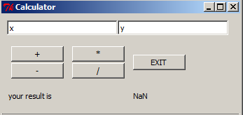
Due to an upcoming presentation about “what is R” and “what can I do with R” in my company I was playing around with GUIs as they are…
The more we work in our special scientific areas and trying to answer often complex questions, we face the problem of the sheer amount of data. Therefore the…
Due to a recent article at our German partner geo-works.de I would like to share my two video tutorials for doing this. The first concentrates on the so…
Some days ago I’ve presented a way to load and monitor the content of a shapefile using pyshp. But since then I was remembering my work with shapefiles…
Unfortunately the qgis package is not available through the Ubuntu Software Center. Yet it is of course possible to install it. Just open the terminal and add the…
In my years at the university i was playing around with a lot of data. These were sorted “somehow” and totally distributed. after a short while i have…
Most of you readers has probably come to a point where you asked yourself “WTF, what is this?”. And doing so by thinking and carrying about projections is…