The Sojus TMA-13M started on May 28th 2014 from Baikonur to bring the German Alex Gerst, the Russian Maxim Surajew and the American Reid Wiseman to the ISS (International Space Station).
Besides the task of the crew to make some experiments etc. on ISS, they show the public how vulnerable and beautiful our blue planet is.
There are different ways they try to do it: Regular public calls and interviews to the crew members bring the earth population in contact with the members. If you’re following one of those members on Twitter or Facebook I’m sure you’re impressed by the pictures they are posting. If not, it’s worthy to follow! Find the twitter accounts below.

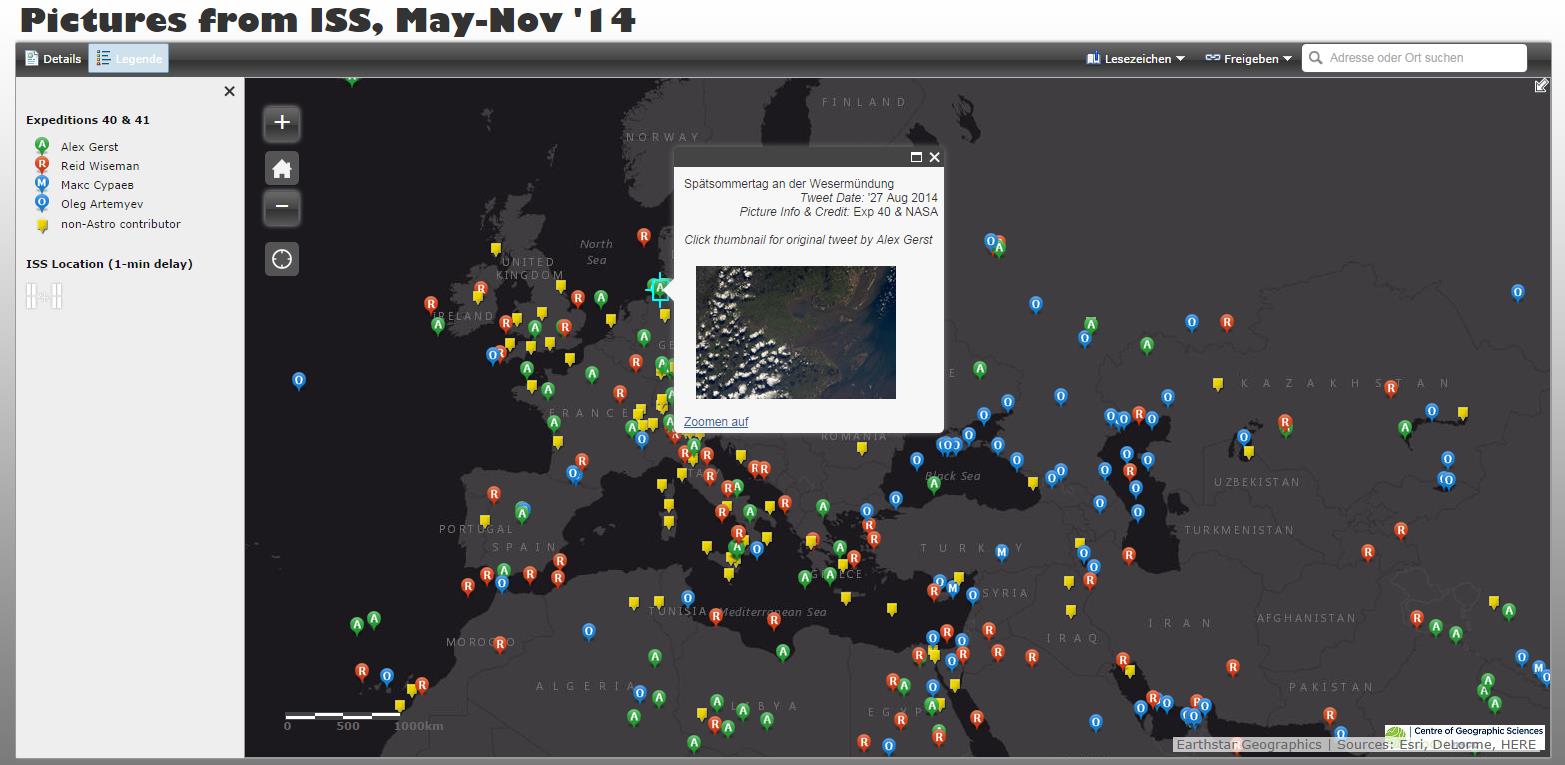
But the reason for this blog post is the interactive space image map, Dave MacLean of the Centre of Geographic Sciences in Nova Scotia has published recently. The interactive image map, created with ArcGIS Online (good exapmple for the ESRI MOOC) contains all the pictures the astronauts are posted on twitter in the period between May and November (will be updated) 2014. You can click on each icon the see a short despriction (the tweet) on what you can see, the tweet date, the location and – of course – the image.
Just explore the map to see all the astonishing photos!
Find the map here fullscreen or explore it directly here: