Since the start of Google Earth in 2001 (it was re-released in 2005 after Google acquired it from Keyhole, Inc ) remote sensing images made their way into every day life. But if you are looking at the images they show on Google Earth or Google Maps: You will see historic data and it strongly depends on companies like Digital Globe, BlackBridge (a.k.a. RapidEye) or Astrium and the contracts with Google whether you will see new or old data. Beginning 2013 this will probably end as there are new companies in the market whith stunning ideas and incredible projects. Most of them are focussed on providing high resoultion images of the Earth at low costs. The concepts behind it are two-folded.
small size, low orbit
The company Planet Labs has a great approach: build cameras with common technology, send them into space at a low orbit and let them take great photos of planet Earth. Due to the small size of those satellites the costs are not that high (according to this approx. 8000$:

The current lifetime of this satellites is about half a year up to two years (source 1, source 2) as they are flying at a height of approx 400-600km and have just small options for holding the orbit height but this is often long enough to fly over distinct areas several times which then can be captured at a resolution of 3-4m. Due to the fact that Planet Labs launched 28 satellites (“Flock-1”) on January the 9th as piggy-back payload of the CRS Orb-1 mission we will get an idea of the possibilities of this kind of satellites for Earth observation in just a few weeks. I am curious.
on the shoulder of giants
There is a really huge things flying over us which is called the International Space Station and since Chris Hadfields video recording up there we probably all know that you have a great view from up there down on our heads:
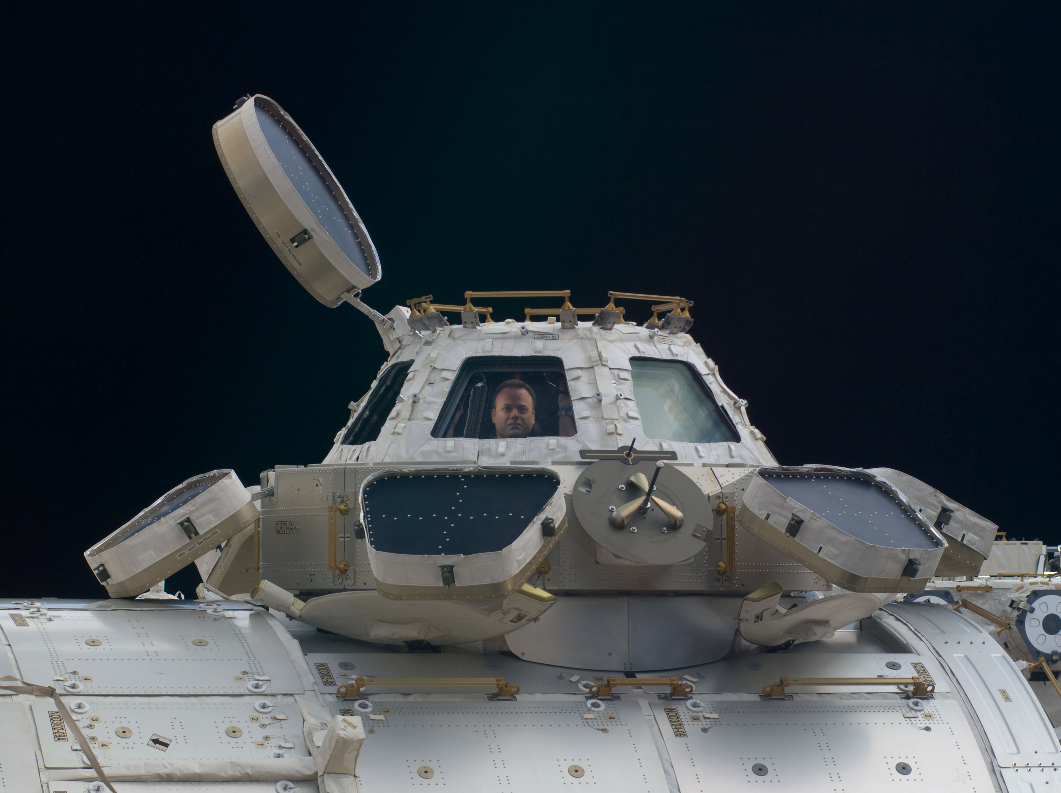
So what about sharing this great view? Exactly this is what the plans of UrtheCast are about. Due to a strange deal with the Russian Government UrtheCast has now the chance to take pictures from our good old lady Earth at nearly no costs as the start/transport and the installation are financed by Russia in exchange for images of the Russian territory. Every other images are available for sale and the UrtheCast is the company with a big smile on their faces. Unfortunately the installation of the two cameras has failed till now.
UrtheCast will provide images on a 40km wide swath with a ground resolution of 5m. Additionally they will shoot 60s videos with 1m resolution in 4k quality. The biggest problem to me is: As the cameras are attached to the ISS the whole project will onlay cover the areaa between 51°N and 51°S:

Sorry guys in Kobenhavn, Oslo, St. Petersburg and many other big cities: No stream for you…
video killed the static satellite
So there are those great new companies with their nice photos and small clips…When it comes to Skybox this is just the first part of a new product category: data from space.
Skybox Imaging Captures World’s First High-Resolution, HD Video from Space from Skybox Imaging on Vimeo
Skybox offers not only pictures and videos from space but also on demand data analysis, periodic monitoring and on-demand access to the satellite itself with the SkyNode system: an antenna and a preconfigured rack to provide access to the system in less then 20min. Frightning a little as you can imagine when watching the above video. One advantage might be the limitation of scale. Skybox will provide sub-meter resolution but at the moment it is prohibited to sell satellite images with better quality then 50cm in the US. I don’t think they want to limit their market that much 😉
conclusions
<
p style=”text-align: justify;”>I enjoy the idea of many companies in this growing markets as it will probably reduce the costs of satellite images for scientific purposes and increase customer awareness. Nevertheless it is a shame for national/international space agencies that there are no high-res images of the world available for free for scientific purposes at the moment. If you are short in money, it is hard to get images better than 30m pixel width. But the agencies spend 650 million EUR to provide a map of the universe but we are still not able to produce a high-res DEM at no costs like the good old SRTM or plain photos at 50cm resolution of the world. Especially when it comes to polar and remote regions this would be extremely useful and minimize spatial orientated project costs.
But at the moment let us look forward and enjoy beautiful videos and images from these new companies.

[…] Since the start of Google Earth in 2001 (it was re-released in 2005 after Google acquired it from Keyhole, Inc ) remote sensing images made their way into every day life. But if you are looking at the images they show on Google Earth or Google Maps: You will see historic data and it strongly depends on companies like Digital Globe, BlackBridge (a.k.a. RapidEye) or Astrium and the contracts with Google whether you will see new or old data.Beginning 2013 this will probably end as there are new companies in the market whith stunning ideas and incredible projects. Most… Read more »