“Big data is coming!” Everyday you can read this in current blogs and magazines. Geotagging is one of the special-interest issues of digital-geography and so I want to combine this two fields and introduce you to CLAVIN, the context-based geotagging service of Berico Technologies. The name of this open source project is a summarize of the main functionality “Cartographic Location And Vicinity Indexer” of documents.
In fact the engine extracts locations out of structured and unstructured text documents and presents geographic features with meta data. CLAVIN does the geocoding with help of a gazetteer but goes a step further. It uses “intelligent heuristics” to find out the right results in combination with a fuzzy search to handle with different spellings of a location.
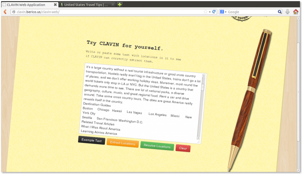
An now it’s time for trying the nice-styled online demo. So I pasted interesting travel tipps (travelling through the USA with nomadicmatt.com) to test the system. And voilá here we go. CLAVIN shows us the geographic locations with coordinates and a counter, which shows how often a specific location is mentioned in the text.

In my mind, CLAVIN is a nice tool, which have a great potential for journalistic an big data applications.
And now it’s your turn. Give CLAVIN a try: http://clavin.berico.us/clavin-web/
[…] See the rest here: CLAVIN – open source context-based geotagging : digital … […]