CSVs and leaflet: the ultimate ressource
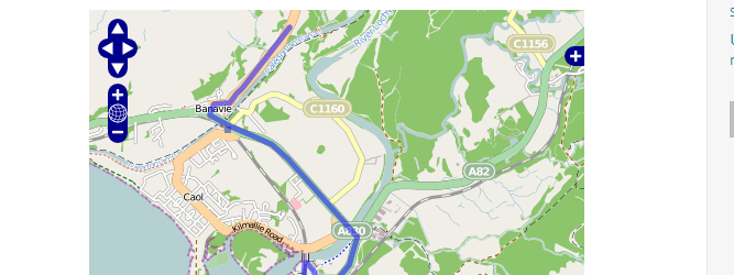
When it comes to certain tasks the usage of leaflet can be tricky. Of course it claims not to be the ultimate webmapping solution but one of the…
When it comes to certain tasks the usage of leaflet can be tricky. Of course it claims not to be the ultimate webmapping solution but one of the…
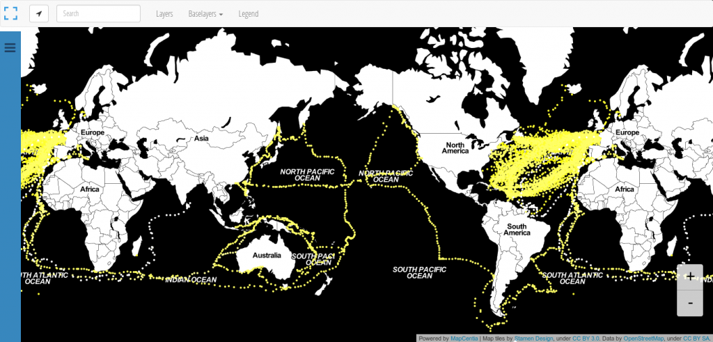
We all know: Black is beautiful. So is this map from Andrew Zolnai. But besides the stunning Stamen toner background map he also shows the significant amount of 260.000…
In contrast to magnitude, which describes the energy release of an earthquake, the intensity of a seismic event describes its effects. Obviously, the intensity value depends on the…
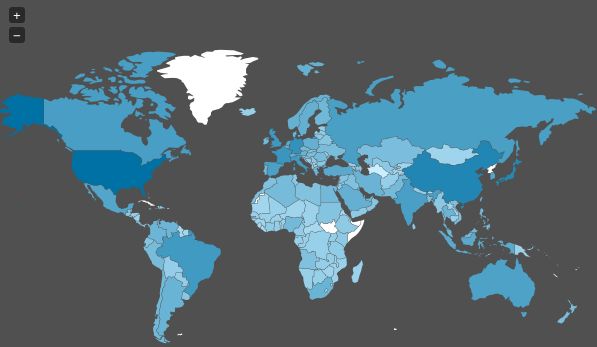
Creating maps is the most appropriate way to present spatial data. In the last years several methods appeared to generate such webmaps. Based on a tile-layer, wich contains…
Thanks to Christoph, he also runs a specific blog on paleoseismicity, who send me the link, I want to share the gizmodo list of best maps 2013 with…

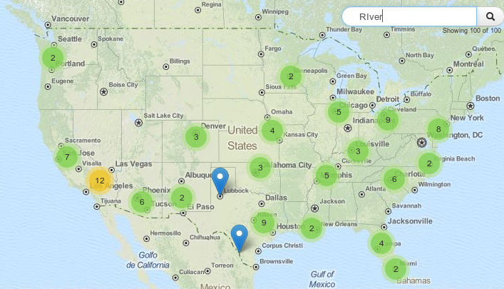
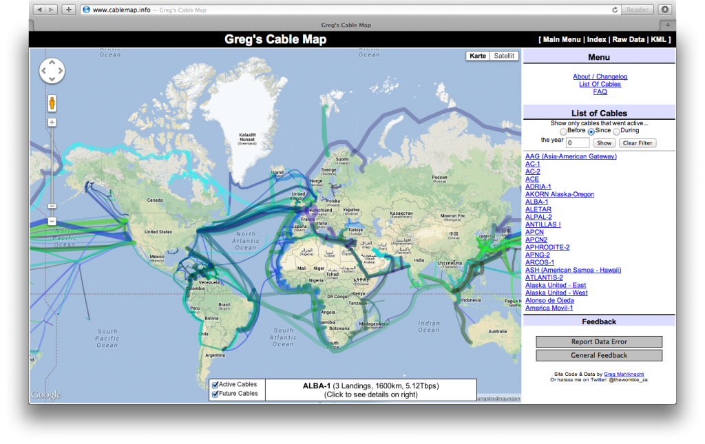
Dear folks, most of you probably know how to map things using software on your pc. Some of you might also know cartoDB. We like their service as…
Today I stumbled upon a “map” on Spiegel Online ( an import news page in Germany ) which shows the spied countries of the NSA. As we already…
To echo the recent tragedies in the island of Lampedusa, I invite you to discover Philippe Rekacewicz’s map collection on the subject. This helps having a global sight…
This week a new 5 weeks course will start at coursera. Coursera is an online learning platform that enables people from all around the world to learn and…
When Mike Bostock published his (re-) implementation and demonstration of Visvalingams algorithm for line simplification he attracted considerable attention on that. What is a little bit strange in…
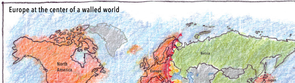
In these days PRISM and TEMPORA are the keywords in global media. United States and Great Britain are two of the (western) global-players which are monitoring global communication…
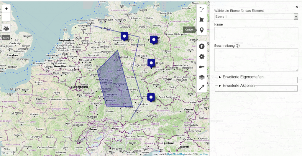
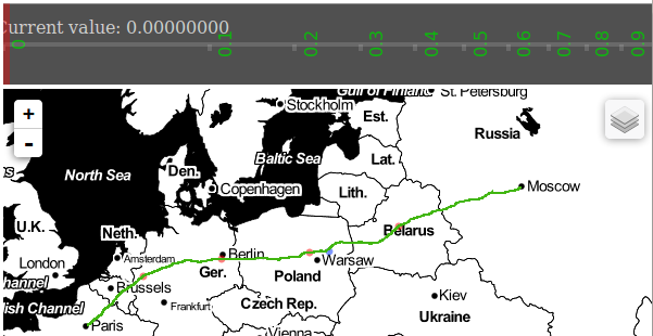
For an upcoming project I was curious about visualizing a line layer using OpenLayers. Therefore I digitized a way with googlemaps. After creating a kml with “my places”…