Some days ago a new version of the ALOS 30m DEM was released:
Void pixels due to clouds and snow pixels within 60 deg. of north and south latitudes in Version 1 were complemented by existing DEMs. Out of the areas are same with Version 1 product.
As we already compared ALOS with SRTM-1(I saw the ALOS DEM as “the winner”) I am now interested in how this performs in a another setting. We are changing our focus from Mongolia to Germany and check how the new ALOS DEM works compared with SRTM 1.
ALOS and SRTM Data
I downloaded the data from USGS EarthExplorer (SRTM 1) and the JAXA webpage. Both files are delivered as TIFFs. The ALOS dataset not only consists of one version but also has the median values of their algorithm results. The area of interest is located in Germany and shows urban structures (Berlin, city) as well as natural features (lakes, moraines and forests).
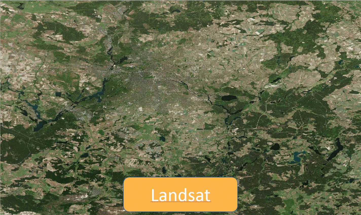
You might get a first overview of the data with this gif:
Berlin/Brandenburg in Landsat, SRTM1 and ALOS
QA results
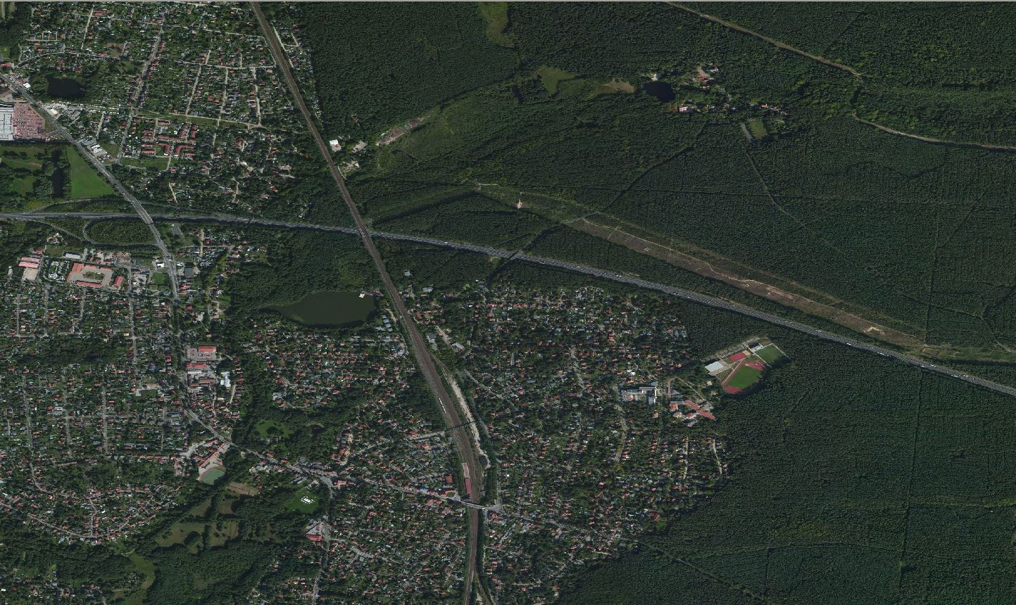
Let’s have a look at the North-Eastern part of this scene first.
Detail of all three scenes (Landsat, SRTM1, ALOS 30)
Prior moaning about the artefacts lets get even closer:
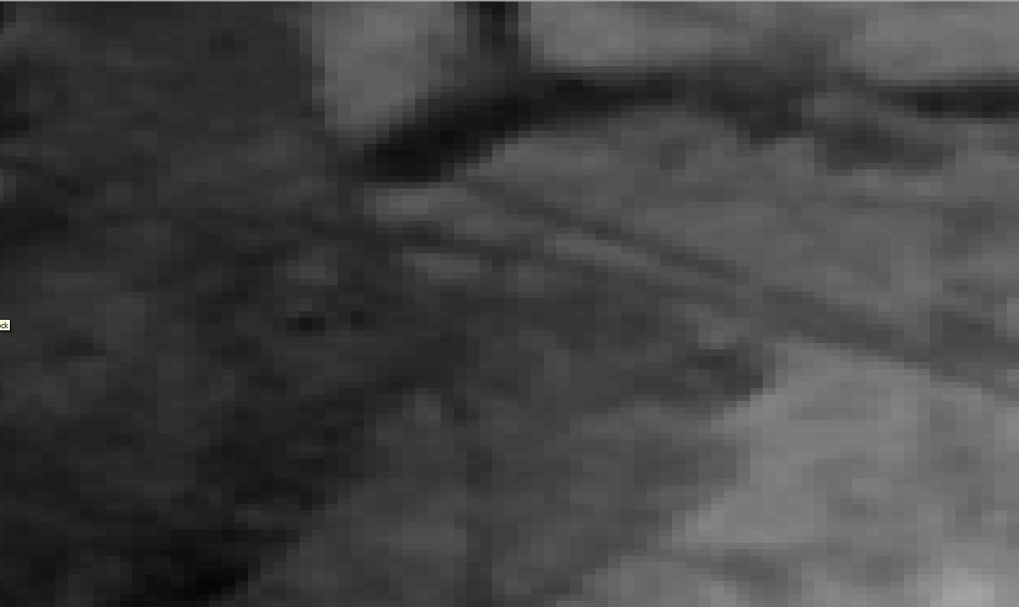
ALOS
Bing Aerial
SRTM 1
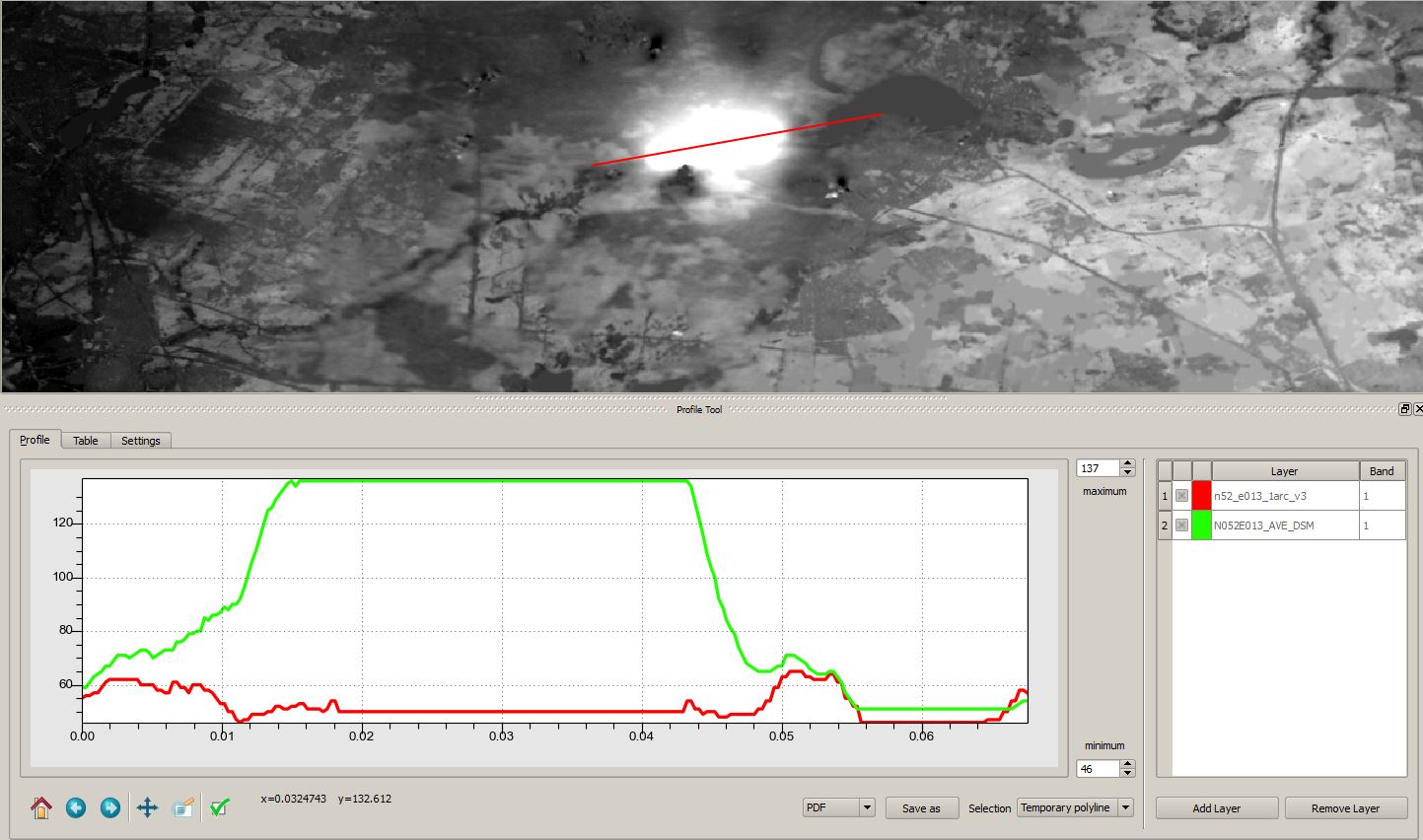
As we can see, the ALOS dataset provides much more detail. This is an optical sensor which operates at a 5x5m ground resolution. This results in a much better contrast even downsampled. We can see much sharper edges where anthropological features appear in the scene (like the highway and other patches). Furthermore the values of forested regions tend to be higher then in non-forested regions. As a SAR is even a bit ground penetrating in dry regions we can see some differences in height values:
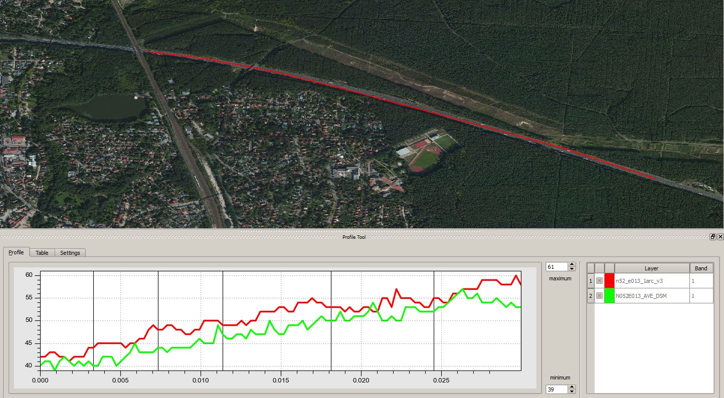
long profile on ALOS (green) and SRTM (green)
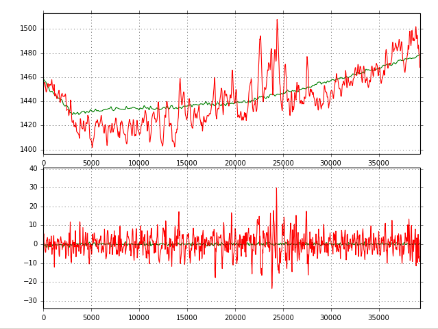
The SRTM values tend to be a bit higher even on “flat” surfaces like this highway:
highway section
So how does it look like on a more or less plain surface? Let’s switch perspective:
Here are the statistics for the Berlin Tempelhof airfield. This is most likely the the smoothest plane you will find across Germany.
airfield Tempelhof
I’ve used a subset of the airfield to create the stats:
min
max
sum
count
mean
std
unique
range
var
median
mode
name
33
58
71946
1524
47.208661
2.286507
25
25
5.228114
48
48
SRTM1
22
83
134642
3050
44.144918
4.154474
48
61
17.259655
44
44
ALOS30
The ALOS dataset performs worse then the SRTM1 data as you can see in the standard variation. Even the mean/median value of SRTM1 is closer to reality of 48m (source Wiki).
We can see here a major problem of ALOS: Even in the new version we have very strong artefacts in cloudy regions! The used algorithm might be very good in regions with low percentages in cloud coverage but it performs not very good in cloudy area.
As you have seen in the first section, here was even a very strange reflection pattern which seems to be a massive plateau but in fact it is just a lake:
plateau/lake in NW of the AOI.
tl;dr
ALOS is cool if you have non cloudy areas and performs even better then SRTM1. If there are clouds quite common in the desired area, precheck data or use SRTM 1 right away!
Really informative and nice comparison article, thanks for your effort.
Niek Schaap
7 years ago
Thank you. I have two remarks:
– the optical sensor of ALOS you refer to (PRISM) has even better resolution 2.5 x 2.5 meter (and not 5 x 5 meter);
– with the ALOS DEMs usually a cloud mask layer is delivered as well, then you know which parts in your aoi are unreliable/unavailable.
Let’s get ready to rumble! No, just kidding. We are all excited about the recent message from the white house: SRTM “1” (1 equals 1 arcsecond, whereas 3…
In one of my last seminars relating remote sensing techniques I was blamed for calculationg the NDVI and SAVI directly with the ModelMaker in Erdas Imagine using digital…


Nice article and comparison, thanks!
Really informative and nice comparison article, thanks for your effort.
Thank you. I have two remarks:
– the optical sensor of ALOS you refer to (PRISM) has even better resolution 2.5 x 2.5 meter (and not 5 x 5 meter);
– with the ALOS DEMs usually a cloud mask layer is delivered as well, then you know which parts in your aoi are unreliable/unavailable.