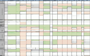
Most of you guys are aware of one or two GIS systems. But what about the functionalities of others? How can you compare these? @Dragons8mycat has done some great work in providing a way to huge excel sheet where he compares nearly all of the available GIS systems.
Yet the the sheet is a bit to detailed but it gives a good insight on what a certain GIS system is capable of. Nicholas ask you to help. So if you have any knowledge about some special software don’t hesitate to work on this xls-sheet here:

Especially proprietary GIS software packages are not covered in the current version of the info sheet (8th of Aug. 2013) so most of our readers should be able to come along with some help. I’ll probably make a first move and update the Erdas Imagine section as it was the software I used most in classes regarding remote sensing. If you have any questions: just drop us a comment.


I can not see the details of the image.. very low res..