Category: ArcGIS

GIF styles

ArcGIS Earth

When I visited university (I have t admit, this was some years ago 😉 ) I was told ArcGIS cannot “do” 3D. This was the part where CAD…

AHP for ArcGIS 10.x using Python

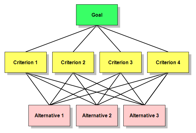
When it comes to site selection problems or suitability models, the spatial Multi-Criteria Analysis (Weighted Overlay) is the most commonly used method. It’s easy, simple and popular. However,…

ArcGIS Open Data

For a year, ESRI’s open data initiative is online. As I’ve heard about it for the first time I was just thinking: nice move to get people into…

GISconnector for Excel

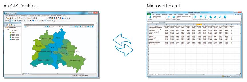
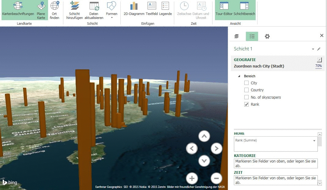
GISconnector for Excel – the beginning of a beautiful friendship between ArcGIS and Excel The GISconnector transforms ArcGIS and Excel into an ingenious overall system: The power of…

Input Dialog Definition

Playing Around With ArcPY…

I was playing around with ArcPY and tried to recreate a version of the qgis2leaf plugin just for ArcGIS just to get to know that ArcGIS doesn’t seem…

Attribute Updating using ArcPy

After my first attempt in Python scripting using opensource Geospatial Data Abstraction Library (GDAL), I wanted to use ArcPy  in my second trial. The following code is so…

ArcGIS 10.3

Yesterday the new major release of worldwide leading GIS solution ArcGIS was released: 10.3. Most users upgraded already to the version 10.x and enjoyed Python support as well…

SciPy integration in ArcGIS

Most of GIS users today will probably work with ArcGIS. Since version 10 the implementation / integration of Python into the ArcGIS framework and ArcPy it’s important for…