One thing I have never kept in mind is the divergence on how shops and agencies store their adresses (more or less like John Doe, 123, Main Street, Anytown, U.S.A ) and the way we store our point-informations (103°E, 45°N). So one problem is,to bring these both things together.
YOu cannot do this straightforward because you need some kind of reference like a georeferenced and digitized or u use such thing like the googlemaps-API.
ArcGIS is also capable of translating this information into points. Just watch the following tutorial and I’ll show you how:
Related Posts
Geocoding Google Spreadsheets
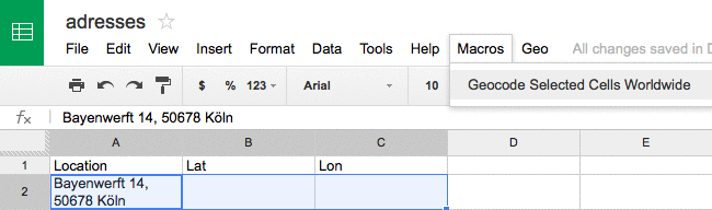
For our job site here on digital-geography I was searching for a way to auto geocode spreadsheet location cells. So I’ve found this very short announcement from Max.…
Geocoding with Microsoft’s Azure Maps
API’s are getting more and more important as some (maybe the majority?) of GIS users don’t want to handle large datasets, don’t want to care about addresses and…
Geocoding in GIS: ArcGIS, QGIS, Leaflet
The recent move from the Mongolian Post to use W3W as their new address system shed a new light on the question: Where are addresses located and how…
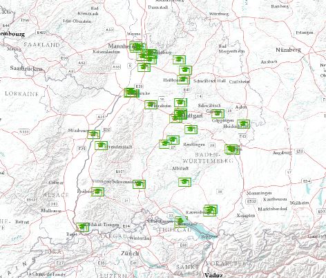
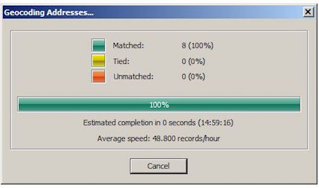
Geocoding Addresses in ArcGIS: the other approach
Today I stumbled upon a post from the German ESRI office and their blog gisIQ and a little tutorial (English translation) on how to geocode addresses in the…
„Dieses Video ist leider privat“ – Gibt es eine Alternative zu diesem Video? Ohne das Video ist dieser Beitrag leider nicht sehr hilfreich. Danke.
due to some legal rights claimed by ESRI I needed to set them at least on private.
send an email with a short statement to blog@statgis.com and I will send you an private invitation. Sorry for the inconvenience.