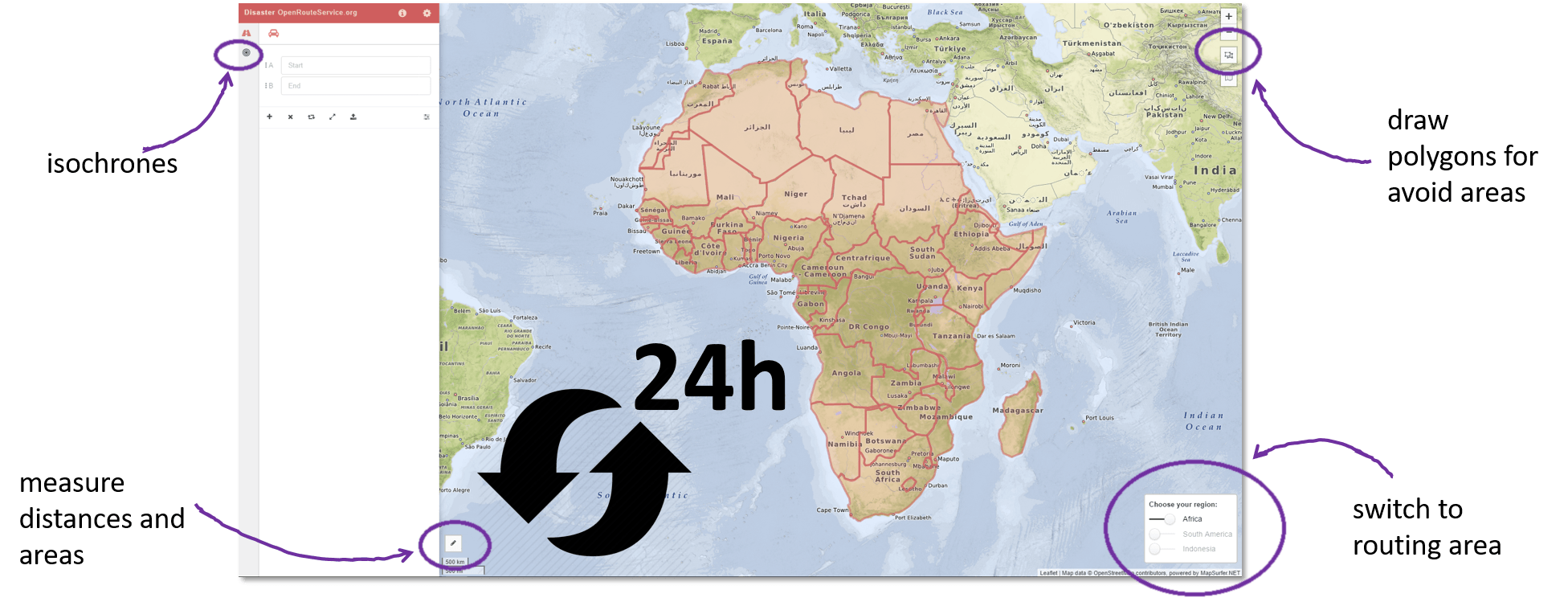
Introduction In my previous two posts I introduced the Cloud based data broker technology ERDDAP and demonstrated how one can use it to obtain geo-spatial scientific environmental data:…
Recently HeiGIT @ GIScience Heidelberg released a dedicated stable disaster versionof OpenRouteService (ORS) to support humanitarian logistics within specific regions of catastrophes with data from OSM in a more sustainable…
What if you want to build your own webmap on your WordPress blog without any knowledge about javaScript, frontend web development and geojsons? You can use a plugin!…
If you are reading this post – you might know something about satellite imagery. This is a valuable source to power quite a lot of analytics and monitoring…
Tiled map layers are an important part of the digital mapping stack, since Google and others introduced their slippy maps quite some time ago. There’s a huge ecosystem…
Geomodelr is the first web geological modeling platform. It helps you to model complex geological settings with simple operations. Additionally, It helps people to share and reuse geological models. Geomodelr…
I want to continue my article “Using the Google Earth Engine (GEE) for Detection of Burned Areas” (link) and describe in detail script for detection burned areas. I decided…