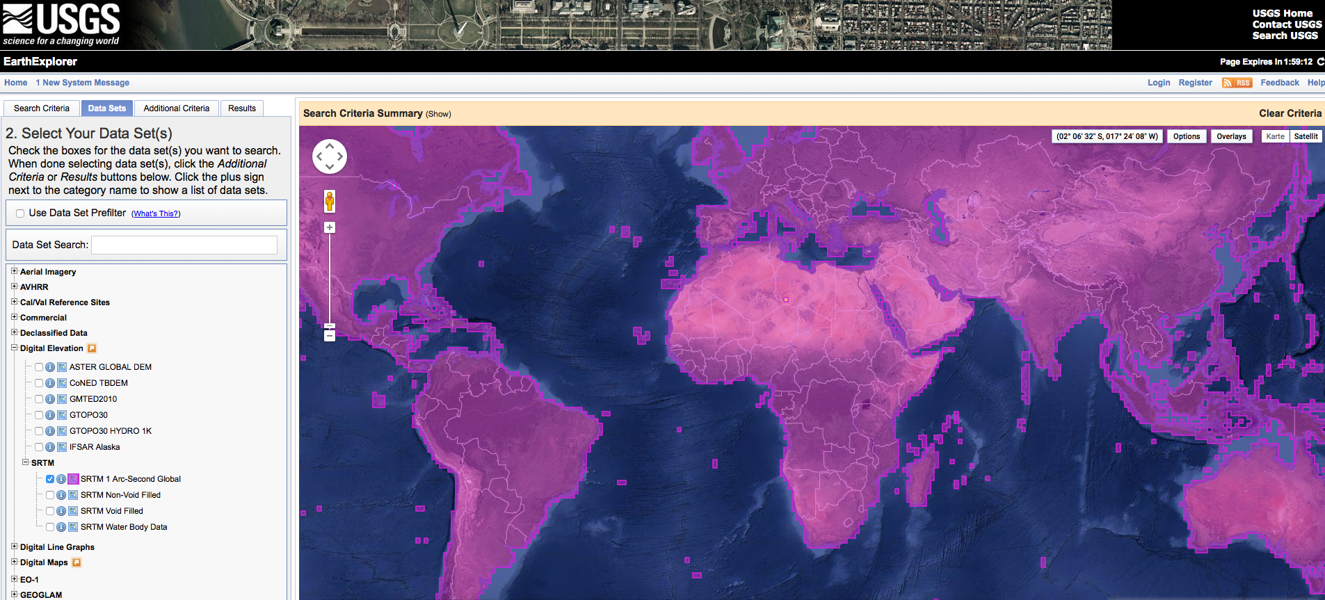
Short Announcement: SRTM 1 Data Worldwide
The digital elevation dataset resulting from the SRT Mission in the year 2000 is probably the most widely used digital elevation dataset in the world. It was first…
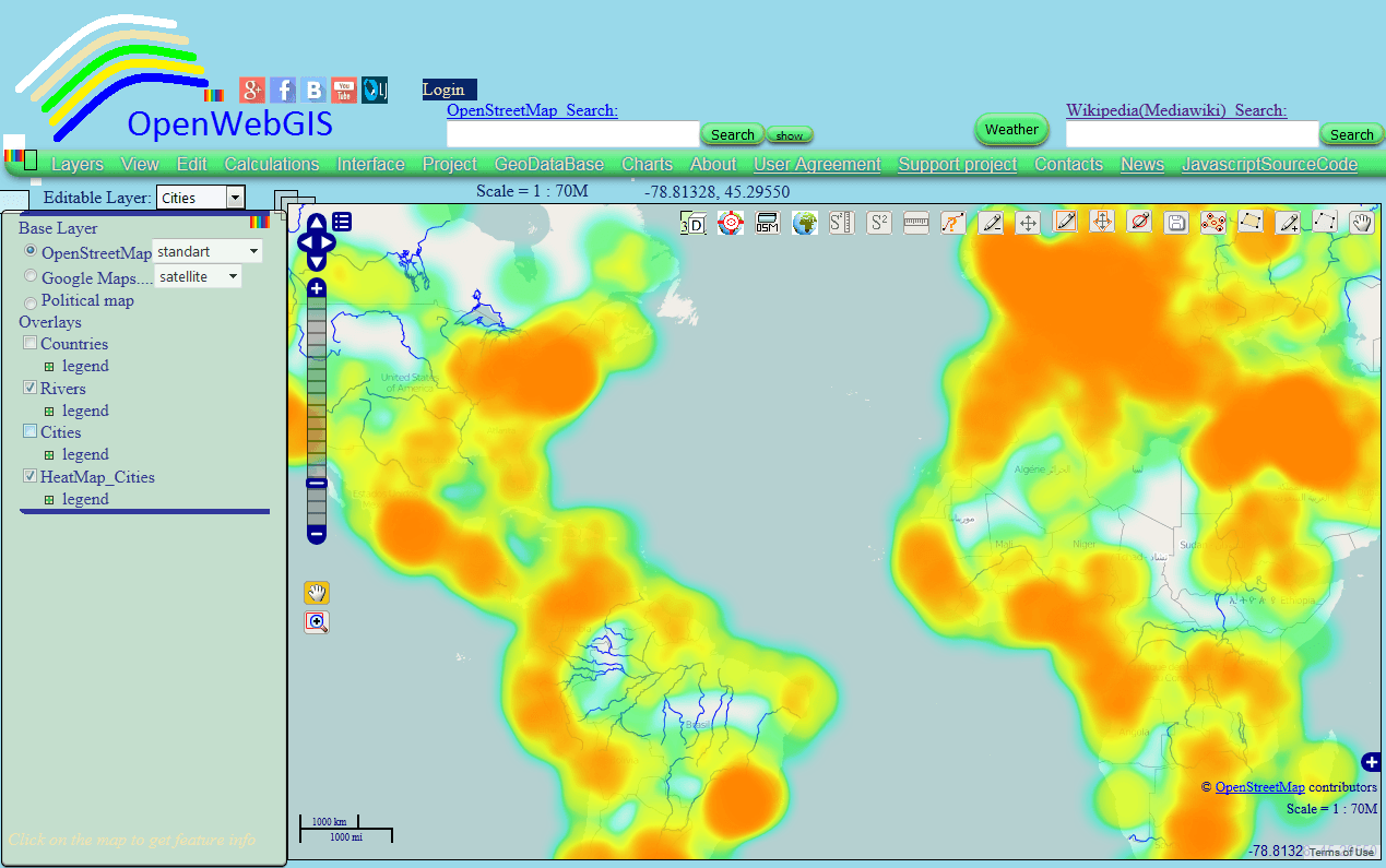
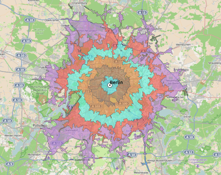
This article is a continuation of the article “Heatmap and Interpolation: it is easy in OpenWebGIS” about creation of Heatmap and Interpolation with the help of OpenWebGIS interface.…
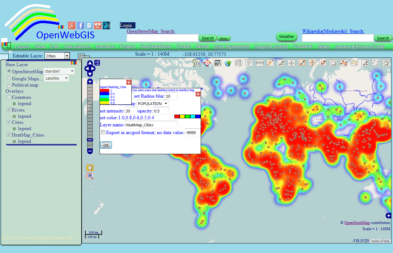
In this article we consider the creation of Heatmap and Interpolation with the help of OpenWebGIS interface. In the next article it is planned to describe its technical…
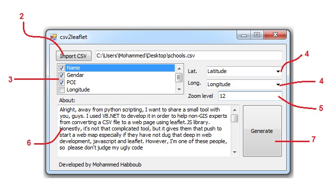
Alright, away from python scripting, I want to share a small tool CSV to HTML 101 with you, guys. I used VB.NET to develop it in order to help…


It’s been a while since I wrote here on DG, but I’ve been busy writing on my own blog in Swedish. However, now it’s time to reveal something…