Mapshaper.org – easy editing polygon and polyline datasets for mapping purposes
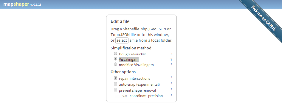
Mapshaper by mbloch is one of my favourite “swiss army knife”-tools if you need fast data reduction and topology first aid in polygon data handling. There a two…
Since 2007 I'm focused on Geography, GIS and remote sensing issues. In 2011 I founded geo-works.de, a german language geoblog. 2012 the blog was merged with geo-affine.org and now contains bilingual content. With new ideas and impetus I try to combine GIS-stuff with originary geographic thoughts, also in business projects.
Mapshaper by mbloch is one of my favourite “swiss army knife”-tools if you need fast data reduction and topology first aid in polygon data handling. There a two…
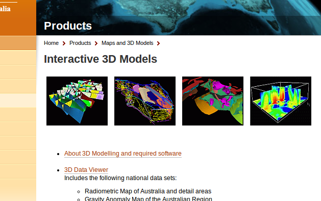
The Australian government now provides a bunch of commercial and free geodata on their Australia Geoscience-Portal. Like the well known U.S. data provider Earth-Explorer, you can do a product…
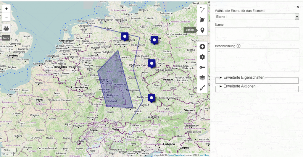
Creating maps is the most appropriate way to present spatial data. In the last years several methods appeared to generate such webmaps. Based on a tile-layer, wich contains…

“Big data is coming!” Everyday you can read this in current blogs and magazines. Geotagging is one of the special-interest issues of digital-geography and so I want to…
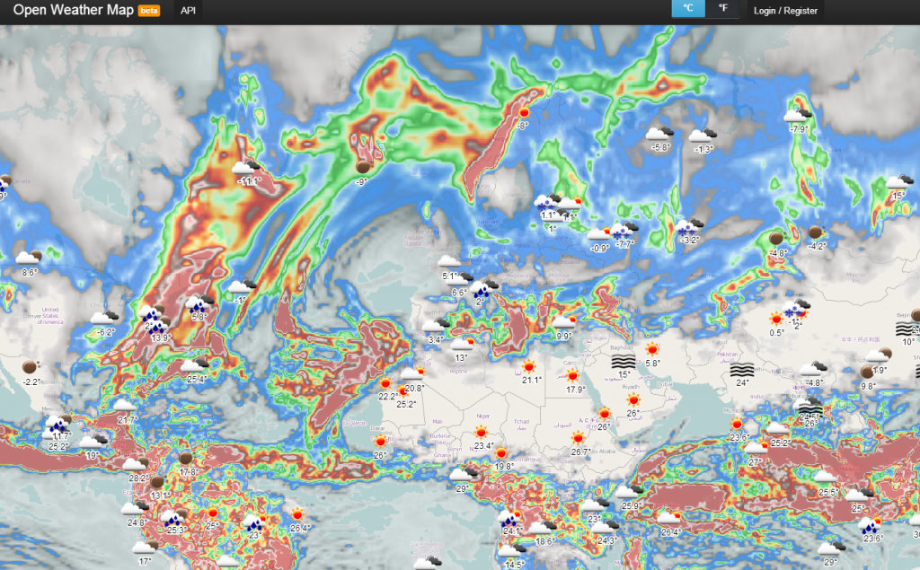
It’s snowing here in Berlin. And I already thought, that we wouldn’t have any white color out there before Christmas Eve. In order to check the weather forecast…
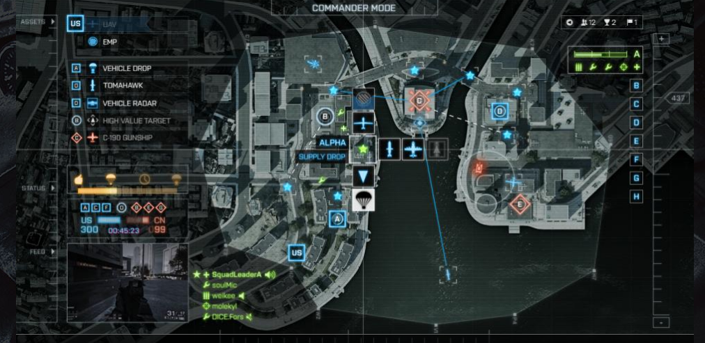
Wer kennt das nicht: nach stressigen Arbeitstagen einfach mal abschalten und sich der elektronischen Unterhaltungsindustrie hingeben. Nichtsahnend startete ich gestern, pünktlich zum Launch, den neuen Actiontitel “Battlefield 4”…
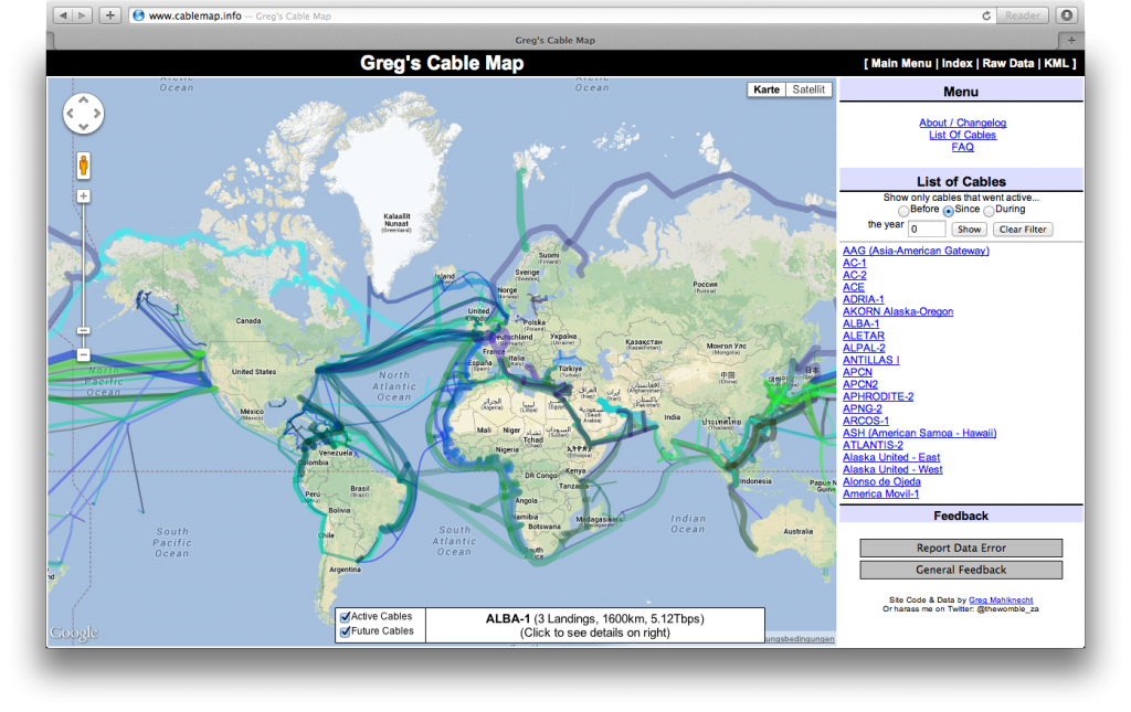
Thanks to @seandebasti who enjoyed this year’s “Society of Cartographers Annual Conference” at Staffordshire University who send us a short link on Twitter. The link provides a huge…
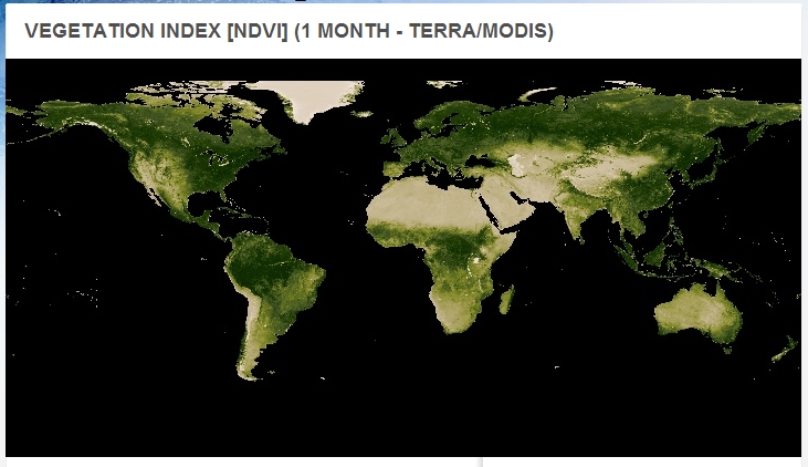
The NASA Earth Observations updated their data archive with fresh NDVI-Datasets from January 2013 to June.

Google’s Earth Engine offers spatial researcher-tools in combination with their huge amount of collected satellite data. In fact you have the possibility to access e.g. 40 years of…
In these days PRISM and TEMPORA are the keywords in global media. United States and Great Britain are two of the (western) global-players which are monitoring global communication…
The joint research centre of the European Commission has published a soil atlas of Europe and Africa. Downloadable as PDF-Parts, they contain informations about the natural soil resources.
Maps are still the main technique to show geomorphological surfaces on different spatial scales. Step by step new technologies try to improve this approach. In this german article…